places in Bangor
United Kingdom
Bangor
Bangor
Administrative Region:
Wales
population:
16 993
calling code:
+44-1248
postcode:
LL57
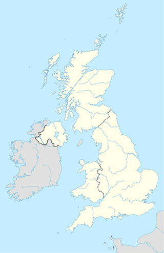
Location on the map of United Kingdom
Bangor
Library
Deiniol Library, Bangor University
Adeilad Deiniol, Bangor
Library
read more
Normal Site Library
2PZ, Holyhead Road, Bangor
Library
read more
Normal Site Library
Holyhead Road, Bangor
Library
read more
Bangor Public Library
Ffordd Gwynedd, Bangor
Library
read more
Neighborhood
Maesgeirchen
United Kingdom
Neighborhood
read more
Maesgeirchen
Zjednoczone Królestwo
Neighborhood
read more
Maesgeirchen
Det Forenede Kongerige
Neighborhood
read more
Point of interest
Parc Menai
4BN, Parc Menai, Bangor
Point of interest
read more
Qanovi Mobiles
Unit 21, Deiniol Shopping Centre, Bangor
Point of interest
read more
Webbers Amusements
226 High Street, Bangor
Point of interest
read more
A5 Taxis
19 Tan Y Coed, Bangor
Point of interest
read more
Get Connected
249 High Street, Bangor
Point of interest
read more
Tryfan Cabs Ltd
28 Penchwintan Road, Bangor
Point of interest
read more
Tidy Tails Bangor
55 Belmont Road, Bangor
Point of interest
read more
Great Roads Of Wales
13 Ffordd Y Castell, Bangor
Point of interest
read more
Tim Snow Driving School
16 Blaen-Y-Wawr, Bangor
Point of interest
read more
Corbett Sports
204 High Street, Bangor
Point of interest
read more
Cool Trader
United Kingdom
Point of interest
read more
LeopardX
43 Llys Bedwyr, Bangor
Point of interest
read more
Beech Lodge
Skenfrith
Point of interest
read more
Ozzmarine Electronics
18 Penrhyn Avenue, Bangor
Point of interest
read more
NWF Fuels Bangor
Goods Yard, Bangor
Point of interest
read more
Locality
Bangor
Bangor
Locality
read more
Minffordd
Minffordd
Locality
read more
Physiotherapist
Pathway Physio
Ty Gwydr - Greenhouse,, 1 Trevelyan Terrace,, Bangor, High Street,
Physiotherapist
read more
📑
Bangor all categories
Accounting
Art gallery
Atm
Bakery
Bank
Bar
Beauty salon
Bicycle store
Book store
Bus station
Cafe
Campground
Car dealer
Car rental
Car repair
Car wash
Cemetery
Church
Clothing store
Convenience store
Dentist
Department store
Doctor
Electrician
Electronics store
Finance
Fire station
Florist
Food
Funeral home
Furniture store
Gas station
General contractor
Grocery or supermarket
Gym
Hair care
Hardware store
Health
Home goods store
Hospital
Insurance agency
Jewelry store
Laundry
Lawyer
Library
Liquor store
Local government office
Locality
Locksmith
Lodging
Meal delivery
Meal takeaway
Mosque
Movie rental
Movie theater
Moving company
Museum
Natural feature
Neighborhood
Night club
Painter
Park
Parking
Pet store
Pharmacy
Physiotherapist
Place of worship
Plumber
Point of interest
Police
Post office
Premise
Real estate agency
Restaurant
Roofing contractor
Route
Rv park, camping
School
Shoe store
Shopping mall
Storage
Store
Supermarket
Train station
Transit station
Travel agency
University
Veterinary care
administrative area level 3
sublocality level 1
↑