Bar nearby The Failand Inn
United Kingdom
Bar nearby The Failand Inn
The Failand Inn
Clevedon Rd, Failand, Bristol Vereinigtes Königreich
contacts phone
:
+44
Latitude:
51.4445
, Longitude:
-2.7001959
read more
nearest Bar
1.927 km
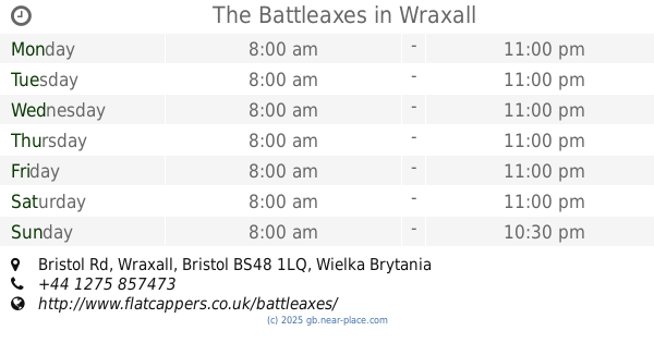
The Battleaxes
Bristol Rd, Wraxall, Bristol
Bar
read more
2.58 km
The Jubilee Inn
Main Road, Flax Bourton, Bristol
Bar
read more
2.728 km
Miners Rest
42 Providence Lane, Long Ashton, Bristol
Bar
read more
3.046 km
Bird In Hand
17 Weston Road, Long Ashton, Bristol
Bar
read more
3.145 km
The Rudgleigh Steakhouse
Martcombe Road, Bristol
Bar
read more
3.251 km
The George at Backwell
125 Farleigh Road, Backwell, Bristol
Bar
read more
3.254 km
The George Inn
Manor Road, Bristol
Bar
read more
3.308 km
Backwell Village Club
12 Backwell Hill Road, Backwell, Bristol
Bar
read more
3.485 km
The Waiting Game
Vines Industrial Estate, High Street, Nailsea, Bristol
Bar
read more
3.497 km
Kings Arms
12 Saint Georges Close, Easton-in-Gordano, Bristol
Bar
read more
3.731 km
The Priory
Station Road, Portbury, Bristol
Bar
read more
3.917 km
The Angel Inn
172 Long Ashton Road, Long Ashton, Bristol
Bar
read more
3.927 km
The Kings Head
3 Heywood Road, Pill, Bristol
Bar
read more
3.951 km
Royal Oak
43 High Street, Nailsea, Bristol
Bar
read more
4.277 km
Duke Of Cornwall
Pump Square, Bristol
Bar
read more
4.388 km
The Princes Motto
Barrow Street, Bristol
Bar
read more
4.553 km
The Dovecote
Bristol
Bar
read more
4.556 km
Black Horse
Clevedon Lane, Bristol
Bar
read more
5.258 km
The George Inn
4-6 High Street, Bristol
Bar
read more
5.58 km
Portishead Town Football Club
Bristol Road, Portishead, Bristol
Bar
read more
6.294 km
The Posset Cup
3, Mustard Way, Portishead
Bar
read more
6.322 km
The Phoenix
Victoria Square, Portishead, Bristol
Bar
read more
6.325 km
The Poacher
106 High Street, Portishead, Bristol
Bar
read more
6.409 km
Hall and Woodhouse
Newfoundland Way, Portishead
Bar
read more
6.515 km
The Old Mill
1 High Street, Portishead, Bristol
Bar
read more
📑
all categories
Accounting
Administrative area level 1
Administrative area level 2
Airport
Amusement park
Aquarium
Art gallery
Atm
Bakery
Bank
Bar
Beauty salon
Bicycle store
Book store
Bowling alley
Bus station
Cafe
Campground
Car dealer
Car rental
Car repair
Car wash
Casino
Cemetery
Church
City hall
Clothing store
Colloquial area
Convenience store
Courthouse
Dentist
Department store
Doctor
Electrician
Electronics store
Embassy
Establishment
Finance
Fire station
Florist
Food
Funeral home
Furniture store
Gas station
General contractor
Grocery or supermarket
Gym
Hair care
Hardware store
Health
Hindu Temple
Home goods store
Hospital
Insurance agency
Jewelry store
Laundry
Lawyer
Library
Light rail station
Liquor store
Local government office
Locality
Locksmith
Lodging
Meal delivery
Meal takeaway
Mosque
Movie rental
Movie theater
Moving company
Museum
Natural feature
Neighborhood
Night club
Painter
Park
Parking
Pet store
Pharmacy
Physiotherapist
Place of worship
Plumber
Point of interest
Police
Political
Post office
Premise
Real estate agency
Restaurant
Roofing contractor
Route
Rv park, camping
School
Shoe store
Shopping mall
Spa
Stadium
Storage
Store
Subpremise
Subway station
Supermarket
Synagogue
Taxi stand
Train station
Transit station
Travel agency
University
Veterinary care
Zoo
administrative area level 3
administrative area level 4
sublocality level 1
↑