Lodging nearby Rosebud Meadow
Coronavirus disease (COVID-19) Situation
confirmed cases
24910387
deaths
232112
United Kingdom
Lodging nearby Rosebud Meadow
Rosebud Meadow
Rosebud Meadow off Marlbank Road, Welland, Welland United Kingdom
contacts phone
:
+44
Latitude:
52.057196
, Longitude:
-2.3060292
read more
nearest Lodging
609 m
Escape to the Malverns at Fleet House
Wood Farm Lane, Marlbank Road, Welland, Malvern
Lodging
read more
632 m
Malvern Hills View at Fleet's Cottage
Fleet house, Marlbank Road, Welland, Malvern
Lodging
read more
697 m
Holdfast Cottage Hotel
Marlbank RoadWelland, Malvern WR13 6NA
Lodging
read more
6.685 km
Viscount Cobham Court
Viscount Cobham Court, Malvern
Lodging
read more
8.737 km
The Corn Mill
Townend Farm, Ledbury
Lodging
read more
8.766 km
Townend Hop Farm
Bosbury, Ledbury
Lodging
read more
10.339 km
The Quiet Woman
Nr Malvern, Ridgeway Cross, Malvern
Lodging
read more
10.549 km
Bed and Breakfast Worcester
Jennett Tree Lane, Callow End, Worcester
Lodging
read more
10.674 km
Ashcroft Cottage
Powick, Worcester
Lodging
read more
10.845 km
Whitewells Farm Cottages Ltd
Ridgeway Cross
Lodging
read more
11.075 km
Stanbrook Abbey
Callow End, Worcester
Lodging
read more
11.086 km
Woodland View B&B
Halfway Lane, Powick
Lodging
read more
12.422 km
Daybrook House
King's End Road, Powick, Worcester
Lodging
read more
12.727 km
The Posthouse Powick
Ham Lane, Powick, Worcester
Lodging
read more
12.772 km
Eckington Manor
Hammock Road, Eckington, Pershore
Lodging
read more
13.938 km
New Barn Holiday House
Chapel House, School Road, Apperley
Lodging
read more
13.99 km
Hop Pickers Rural Retreats. 4 Star Self Catering Barn, Cabin and Shepherd's Hut in Worcestershire.
Dingle Road, Worcester
Lodging
read more
14.19 km
Upper Clattsmore Farm
Tewkesbury Road, Pershore
Lodging
read more
14.858 km
Worcester University
95 Foley Road, Worcester
Lodging
read more
15.26 km
St Lawrence Hotel
29 Bolston Road, Worcester
Lodging
read more
15.45 km
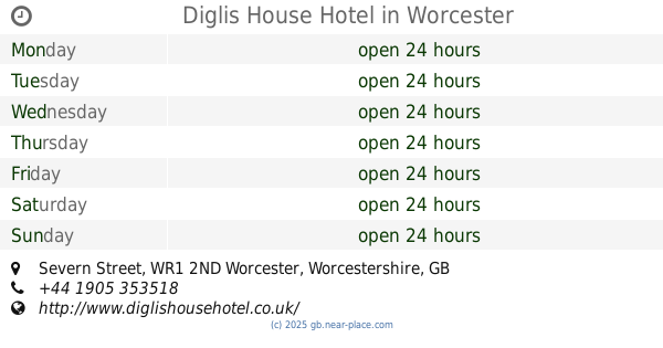
Diglis House Hotel
Severn Street, Worcester, Worcestershire
Lodging
read more
15.775 km
The College Street Apartments
26 College Street, Worcester
Lodging
read more
16.065 km
The Berrow
9 New Street, Worcester
Lodging
read more
16.079 km
The Abberley
Abberley Apt 1, No:9 New Street, Worcester
Lodging
read more
19.982 km
Hop Pole Hotel
Market Square, Bromyard
Lodging
read more
📑
all categories
Accounting
Administrative area level 1
Administrative area level 2
Airport
Amusement park
Aquarium
Art gallery
Atm
Bakery
Bank
Bar
Beauty salon
Bicycle store
Book store
Bowling alley
Bus station
Cafe
Campground
Car dealer
Car rental
Car repair
Car wash
Casino
Cemetery
Church
City hall
Clothing store
Colloquial area
Convenience store
Courthouse
Dentist
Department store
Doctor
Electrician
Electronics store
Embassy
Establishment
Finance
Fire station
Florist
Food
Funeral home
Furniture store
Gas station
General contractor
Grocery or supermarket
Gym
Hair care
Hardware store
Health
Hindu Temple
Home goods store
Hospital
Insurance agency
Jewelry store
Laundry
Lawyer
Library
Light rail station
Liquor store
Local government office
Locality
Locksmith
Lodging
Meal delivery
Meal takeaway
Mosque
Movie rental
Movie theater
Moving company
Museum
Natural feature
Neighborhood
Night club
Painter
Park
Parking
Pet store
Pharmacy
Physiotherapist
Place of worship
Plumber
Point of interest
Police
Political
Post office
Premise
Real estate agency
Restaurant
Roofing contractor
Route
Rv park, camping
School
Shoe store
Shopping mall
Spa
Stadium
Storage
Store
Subpremise
Subway station
Supermarket
Synagogue
Taxi stand
Train station
Transit station
Travel agency
University
Veterinary care
Zoo
administrative area level 3
administrative area level 4
sublocality level 1
↑