Atm nearby ATM
United Kingdom
Atm nearby ATM
ATM
117 Latimer Street, Liverpool United Kingdom
contacts phone
:
+44
Latitude:
53.4257202
, Longitude:
-2.9865065
read more
nearest Atm
604 m
ATM
324 Scotland Road, Liverpool
Atm
read more
876 m
ATM
238 Stanley Road, Liverpool
Atm
read more
884 m
ATM
Kingsway Court, Liverpool
Atm
read more
887 m
Cashzone
13 Walton Road, Liverpool
Atm
read more
894 m
ATM
13 Walton Road, Liverpool
Atm
read more
972 m
ATM
99 Saint Domingo Road, Liverpool
Atm
read more
1.128 km
Henney Self Drive
United Kingdom
Atm
read more
1.147 km
ATM
121-129 Great Howard Street, Liverpool
Atm
read more
1.409 km
ATM
30 Waterloo Road, Liverpool
Atm
read more
1.461 km
ATM
191 Westminster Road, Liverpool
Atm
read more
1.492 km
ATM
3 Byrom Street, Liverpool
Atm
read more
1.494 km
Atm (John Moores)
Liverpool
Atm
read more
1.613 km
ATM Shell
74-80 Derby Road, Liverpool
Atm
read more
1.653 km
ATM
250-252 Walton Road, Liverpool
Atm
read more
1.81 km
ATM
163 Oakfield Road, Liverpool
Atm
read more
1.828 km
ATM (BT Kiosk Spellow Lane)
O/s Goodison Park Staduim, Jct Goodison Road/Spellow Lane, Liverpool
Atm
read more
1.849 km
ATM
188-190 Breck Road, Liverpool
Atm
read more
1.901 km
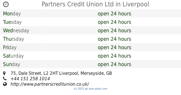
Partners Credit Union Ltd
75 Dale Street, Liverpool
Atm
read more
1.903 km
ATM (Snax 24 - Islington Road 827)
25 New Islington Road, -
Atm
read more
1.946 km
ATM Moorfields Train Station
2 Moorfields, Liverpool
Atm
read more
1.959 km
Barclays ATM
Breck Road, Asda, Liverpool
Atm
read more
1.976 km
ATM (Genting Club Queen Square)
3 Queen Square, Liverpool
Atm
read more
1.988 km
ATM
87 London Road, Liverpool
Atm
read more
2.014 km
ATM
102 County Road, Liverpool
Atm
read more
2.237 km
ATM (Tesco Express)
Prescot Street, Liverpool
Atm
read more
📑
all categories
Accounting
Administrative area level 1
Administrative area level 2
Airport
Amusement park
Aquarium
Art gallery
Atm
Bakery
Bank
Bar
Beauty salon
Bicycle store
Book store
Bowling alley
Bus station
Cafe
Campground
Car dealer
Car rental
Car repair
Car wash
Casino
Cemetery
Church
City hall
Clothing store
Colloquial area
Convenience store
Courthouse
Dentist
Department store
Doctor
Electrician
Electronics store
Embassy
Establishment
Finance
Fire station
Florist
Food
Funeral home
Furniture store
Gas station
General contractor
Grocery or supermarket
Gym
Hair care
Hardware store
Health
Hindu Temple
Home goods store
Hospital
Insurance agency
Jewelry store
Laundry
Lawyer
Library
Light rail station
Liquor store
Local government office
Locality
Locksmith
Lodging
Meal delivery
Meal takeaway
Mosque
Movie rental
Movie theater
Moving company
Museum
Natural feature
Neighborhood
Night club
Painter
Park
Parking
Pet store
Pharmacy
Physiotherapist
Place of worship
Plumber
Point of interest
Police
Political
Post office
Premise
Real estate agency
Restaurant
Roofing contractor
Route
Rv park, camping
School
Shoe store
Shopping mall
Spa
Stadium
Storage
Store
Subpremise
Subway station
Supermarket
Synagogue
Taxi stand
Train station
Transit station
Travel agency
University
Veterinary care
Zoo
administrative area level 3
administrative area level 4
sublocality level 1
↑