Atm nearby Nationwide
United Kingdom
Atm nearby Nationwide
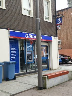
Nationwide
Marcus Square, BT34 1JB, Newry, Newry and Mourne, GB United Kingdom
contacts phone
:
+44 800 554 0559
website:
www.nationwide.co.uk
Latitude:
54.175232
, Longitude:
-6.337661
larger map & directions
read more
nearest Atm
95 m
ATM (Newry Branch)
63 Hill Street, Newry
Atm
read more
116 m
The Strain Practice
16 Margaret Street, Newry
Atm
read more
118 m
Euro Atm
Kildare Street, Newry
Atm
read more
128 m
ATM (Barclays Bank Plc)
32 Hill Street, Newry
Atm
read more
201 m
ATM
25 Merchants Quay, Newry
Atm
read more
225 m
ATM
2 Monaghan Street, Newry
Atm
read more
302 m
ATM (The Bank Bar)
12 Trevor Hill, Newry
Atm
read more
331 m
ATM (Dunnes Stores)
Old Creamery, Monaghan Street, Newry
Atm
read more
339 m
ATM (Vegas Casino)
4 Corn Market, Newry
Atm
read more
387 m
ATM (LA Drinks - Canel Street)
1 Canal Street, Newry
Atm
read more
460 m
ATM (Poundland Newry)
32 Buttercrane Quay, Newry
Atm
read more
617 m
ATM (The Railway Bar)
79-81 Monaghan Street, Newry
Atm
read more
872 m
ATM (Tesco)
24 Downshire Road, Carneyhough, Newry
Atm
read more
1.6 km
ATM (Clarkes BP Newry)
Belfast Road, Newry
Atm
read more
22.826 km
ATM
125 Annareagh Road, Hamiltonsbawn, Armagh
Atm
read more
26.68 km
ATM
132 Newry Rd, Armagh
Atm
read more
27.785 km
ATM
2 Monaghan Road, Armagh
Atm
read more
27.869 km
ATM
19 College Hill, Portadown Road, Armagh
Atm
read more
28.137 km
Armagh Credit Union
3 Russell Street, Armagh
Atm
read more
28.143 km
ATM (Toby Jug)
65 Upper Irish Street, Armagh
Atm
read more
28.47 km
ATM
1 Killylea Road, Armagh
Atm
read more
28.57 km
ATM
10 Cathedral Road, Armagh
Atm
read more
29.135 km
ATM (Costcutter)
82 Cathedral Road, Armagh
Atm
read more
31.282 km
ATM (Hughes Service Station)
63 Moy Road, Armagh
Atm
read more
31.777 km
ATM
63 Moy Road, Armagh
Atm
read more
📑
all categories
Accounting
Administrative area level 1
Administrative area level 2
Airport
Amusement park
Aquarium
Art gallery
Atm
Bakery
Bank
Bar
Beauty salon
Bicycle store
Book store
Bowling alley
Bus station
Cafe
Campground
Car dealer
Car rental
Car repair
Car wash
Casino
Cemetery
Church
City hall
Clothing store
Colloquial area
Convenience store
Courthouse
Dentist
Department store
Doctor
Electrician
Electronics store
Embassy
Establishment
Finance
Fire station
Florist
Food
Funeral home
Furniture store
Gas station
General contractor
Grocery or supermarket
Gym
Hair care
Hardware store
Health
Hindu Temple
Home goods store
Hospital
Insurance agency
Jewelry store
Laundry
Lawyer
Library
Light rail station
Liquor store
Local government office
Locality
Locksmith
Lodging
Meal delivery
Meal takeaway
Mosque
Movie rental
Movie theater
Moving company
Museum
Natural feature
Neighborhood
Night club
Painter
Park
Parking
Pet store
Pharmacy
Physiotherapist
Place of worship
Plumber
Point of interest
Police
Political
Post office
Premise
Real estate agency
Restaurant
Roofing contractor
Route
Rv park, camping
School
Shoe store
Shopping mall
Spa
Stadium
Storage
Store
Subpremise
Subway station
Supermarket
Synagogue
Taxi stand
Train station
Transit station
Travel agency
University
Veterinary care
Zoo
administrative area level 3
administrative area level 4
sublocality level 1
↑