places in Bradford
United Kingdom
Bradford
Bradford
Administrative Region:
England
population:
333 931
calling code:
+44-1274
postcode:
BD1-BD15
Location on the map of United Kingdom
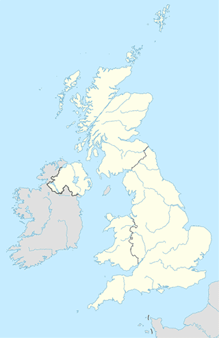
Bradford
Supermarket
Asda Greengates Supermarket
147 New Line, Bradford
Supermarket
read more
Tesco Express
159 Huddersfield Road, Low Moor, Bradford
Supermarket
read more
Akas Checkout
191b Otley Road, Bradford
Supermarket
read more
McColl's
53 Great Horton Road, Bradford
Supermarket
read more
Tesco Express
465-469 Otley Road, Bradford
Supermarket
read more
Fortune Dragon Oriental Food Store
6 Mannville Terrace, Bradford
Supermarket
read more
Fultons Foods
31 John Street, Bradford
Supermarket
read more
A & K Patel
485 Leeds Road, Bradford
Supermarket
read more
Morrisons
110 Mayo Avenue, Bradford
Supermarket
read more
Farmfoods Ltd
921 Harrogate Road, Greengates, Bradford, Bradford Greengates
Supermarket
read more
The Co-operative Food
191 Otley Road, Bradford
Supermarket
read more
Asia Superstore
121 Fairbank Road, Bradford
Supermarket
read more
Costcutter
495 Otley Road, Bradford
Supermarket
read more
Manningham Superstore
Carlisle Road, Bradford
Supermarket
read more
Spencer foods
2 Spencer Road, Bradford
Supermarket
read more
Bus station
Lumb Lane Darfield St
United Kingdom
Bus station
read more
Sunbridge Road (Stop S7)
Bradford
Bus station
read more
Westgate (stop W5)
United Kingdom
Bus station
read more
Interchange (Stand P)
United Kingdom
Bus station
read more
Lilycroft Road Police Hq
United Kingdom
Bus station
read more
Church Bank (stop P9)
United Kingdom
Bus station
read more
Lumb Lane Huddersfield Rd
United Kingdom
Bus station
read more
St Marys Rd Oak Lane
United Kingdom
Bus station
read more
Highbridge Terrace
United Kingdom
Bus station
read more
Halifax Rd Smith Avenue
United Kingdom
Bus station
read more
Manningham Lane Thurnscoe Rd
United Kingdom
Bus station
read more
Cooper Lane Beacon Rd
United Kingdom
Bus station
read more
Wilmer Rd Park View Rd
United Kingdom
Bus station
read more
Rooley Avenue Grattan Stadium
United Kingdom
Bus station
read more
Great Horton Road Windermere Rd
United Kingdom
Bus station
read more
Night club
Club Railway
Wakefield Road, Bradford
Night club
read more
Titan Pub Solutions Ltd
Suite 8 Low Moor Business Park, Common Road, Low Moor, Bradford
Night club
read more
TRASH
1 Sackville Street, Bradford
Night club
read more
Envy Nightclub
11 Great Horton Road, Bradford
Night club
read more
Deja Vu
Bradford
Night club
read more
The Mill Night Club
262 Thornton Road, Bradford
Night club
read more
iDecades Roadshow
83 Grange Road, Allerton, Bradford
Night club
read more
Tiki-O Bradford
The Windsor Baths, Morley Street, Bradford
Night club
read more
Candy
3B Sackville Street, Bradford
Night club
read more
Vogue Lounge
Bradford
Night club
read more
Tyersal Club
Tyersal Road, Bradford
Night club
read more
Flares & Reflex
Morley Street, Bradford
Night club
read more
FFD Mobile Discos
43 Eastbury Avenue, Bradford
Night club
read more
Envy Bar
11 Great Horton Road, Bradford
Night club
read more
Ne2 Nighclub
3 Salem Street, Bradford
Night club
read more
Route
Westgate
United Kingdom
Route
read more
Westgate
Zjednoczone Królestwo
Route
read more
sublocality level 1
Manningham
Manningham
sublocality level 1
read more
Broomfields
Broomfields
sublocality level 1
read more
Bowling
Bowling
sublocality level 1
read more
Fieldhead Business Centre
sublocality level 1
read more
📑
Bradford all categories
Accounting
Administrative area level 2
Airport
Amusement park
Art gallery
Atm
Bakery
Bank
Bar
Beauty salon
Bicycle store
Book store
Bowling alley
Bus station
Cafe
Car dealer
Car rental
Car repair
Car wash
Casino
Cemetery
Church
City hall
Clothing store
Convenience store
Courthouse
Dentist
Department store
Doctor
Electrician
Electronics store
Embassy
Finance
Fire station
Florist
Food
Funeral home
Furniture store
Gas station
General contractor
Grocery or supermarket
Gym
Hair care
Hardware store
Health
Hindu Temple
Home goods store
Hospital
Insurance agency
Jewelry store
Laundry
Lawyer
Library
Liquor store
Local government office
Locality
Locksmith
Lodging
Meal delivery
Meal takeaway
Mosque
Movie rental
Movie theater
Moving company
Museum
Natural feature
Neighborhood
Night club
Painter
Park
Parking
Pet store
Pharmacy
Physiotherapist
Place of worship
Plumber
Point of interest
Police
Post office
Premise
Real estate agency
Restaurant
Roofing contractor
Route
School
Shoe store
Shopping mall
Spa
Stadium
Storage
Store
Subpremise
Supermarket
Synagogue
Taxi stand
Train station
Transit station
Travel agency
University
Veterinary care
Zoo
administrative area level 4
sublocality level 1
↑