Cafe i nærheden Cafe 33
Det Forenede Kongerige
Cafe i nærheden Cafe 33
Cafe 33
33 Witard Road, Norwich Zjednoczone Królestwo
kontakter telefon
:
+44
Latitude:
52.6412849
, Longitude:
1.3367087
læs mere
nærmeste Cafe
952 m
The Place, Gateway Vineyard Norwich
61 Spinney Road, Norwich
Cafe
læs mere
1.475 km
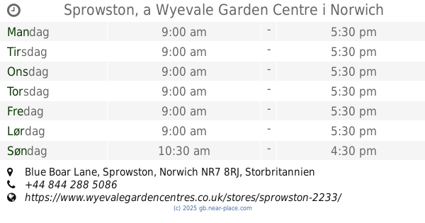
Sprowston, a Wyevale Garden Centre
Blue Boar Lane, Norwich
Cafe
læs mere
1.475 km
Wyevale
Blue Boar Lane, Sprowston, Norwich
Cafe
læs mere
1.475 km
Sprowston, a Wyevale Garden Centre
Blue Boar Lane, Sprowston, Norwich
Cafe
læs mere
1.578 km
Wild Bean Cafe
58 Mousehold Lane, Norwich
Cafe
læs mere
1.601 km
Cafe Britannia
Britannia Road, Norwich
Cafe
læs mere
1.686 km
Harleys
77 Yarmouth Road, Norwich
Cafe
læs mere
2.06 km
Sainsbury's Cafe
47 Mary Chapman Close, Norwich
Cafe
læs mere
2.247 km
Dixies Diner
81 School Lane, Norwich
Cafe
læs mere
2.345 km
Tiffins
102 Thorpe Road, City Centre, Norwich
Cafe
læs mere
2.356 km
The Terrace Cafe
2 Central Avenue, Norwich
Cafe
læs mere
2.565 km
Starbucks Coffee
Norwich Railway Station, Station Approach, Norwich
Cafe
læs mere
2.664 km
Starbucks Coffee
Riverside Retail Park, 8b, Albion Way, Norwich
Cafe
læs mere
2.666 km
Starbucks Coffee
8B, Riverside Retail Park, Albion Way, Norwich
Cafe
læs mere
2.666 km
Starbucks Coffee
4 Hardy Road, Norwich
Cafe
læs mere
2.7 km
Morrisons Cafe
1 Broadsman Close, Norwich
Cafe
læs mere
2.767 km
The Light Kebab & Pizza House
Magdalen Street, Norwich
Cafe
læs mere
2.778 km
Costa Coffee
Riverside Retail Park, Unit 2C, Norwich
Cafe
læs mere
2.778 km
Costa Coffee
2C, Riverside Retail Park, Norwich
Cafe
læs mere
2.818 km
Olives
40 Elm Hill, Norwich
Cafe
læs mere
3.13 km
Take a Break
19 Castle Street, Norwich
Cafe
læs mere
3.226 km
Fresh Stack
10 Timber Hill, Norwich
Cafe
læs mere
3.239 km
The Octagon
Norwich, Norfolk
Cafe
læs mere
3.259 km
Sicily Market Italian Street Food
Newmarket House Clinic, 1, 153 Newmarket Road, Norwich
Cafe
læs mere
3.309 km
Starbucks Coffee
19-20 Haymarket, Norwich
Cafe
læs mere
📑
alle kategorier
Administrative område niveau 1
Administrative område niveau 2
Advokat
Akvarium
Ambassade
Apotek
Bageri
Bank
Bar
Begravelse hjem
Bibliotek
Bilforhandler
Bilreparationer
Bilvask
Biograf
Blikkenslager
Blomsterhandler
Bog butik
Bowlingbaner
Brandstation
Busstoppested
Butik
Bydel niveau 1
Cafe
Campingplads
Cykel butik
Dagligdags område
Dagligvarebutik
Dyrehandel
Dyrlægebehandling
Ejendomsmægler
Elektriker
Elektronik butik
Etablering
Filmudlejning
Finansiere
Flyttefirma
Forlystelsespark
Forsikring agentur
Forudsætning
Fysioterapeut
Guldsmed
Gym
Hindu Temple
Hjem varer butik
Hospital
Hovedentreprenør
Hårpleje
Indkøbscenter
Isenkræmmer
Kasino
Kirke
Kirkegård
Kommunen
Kunstgalleri
Købmand eller supermarked
Letbane station
Logi
Lokalitet
Lufthavn
Låsesmed
Læge
Mad
Maler
Metrostation
Moske
Museum
Måltid levering
Måltid takeaway
Møbelbutik
Nabolag
Natklub
Naturlige træk
Opbevaring
Parkere
Parkering
Pengeautomat
Politi
Politisk
Postkontor
Punkt af interesse
Regnskab
Rejsebureau
Restaurant
Retsbygning
Rute
Rv park, camping
Rådhus
Sko butik
Skole
Skønhedssalon
Spa
Stadion
Sted for tilbedelse
Stormagasin
Subpremise
Sundhed
Supermarked
Synagoge
Tagdækning entreprenør
Tandlæge
Tankstation
Taxaholdeplads
Togstation
Transit station
Tøjbutik
Universitet
Vasketøj
Vinhandel
Zoo
administrative område niveau 3
administrative område niveau 4
biludlejning
↑