Cafe nearby Magenta Café
United Kingdom
Cafe nearby Magenta Café
Magenta Café
35 High Street, Kidlington United Kingdom
contacts phone
:
+44
Latitude:
51.8236048
, Longitude:
-1.288626
read more
nearest Cafe
52 m
Greggs
18 High Street, Kidlington
Cafe
read more
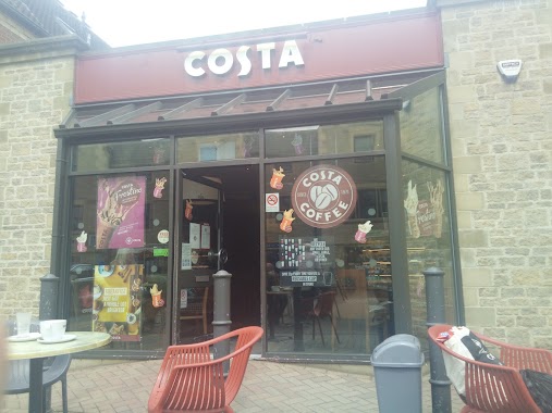
86 m
Costa Coffee
9 High Street, Kidlington
Cafe
read more
120 m
Sammys Cafe Restaurant
3A Oxford Road, Kidlington
Cafe
read more
122 m
Sami's Takeaway
3 Oxford Rd, Kidlington
Cafe
read more
122 m
Sami's Takeaway
3 Oxford Road, Kidlington
Cafe
read more
552 m
Willow Tree Cafe
Moorside Place, The Moors, Kidlington
Cafe
read more
552 m
Willow Tree Cafe
Moorside Place, OX5 2UZ, The Moors, Kidlington
Cafe
read more
1.75 km
Oasis Coffee House
Sandy La, Kidlington
Cafe
read more
1.797 km
Sainsbury's Cafe
289 Oxford Road, Kidlington
Cafe
read more
1.997 km
Annie's Tea Rooms
Canal Yard, Canal Road, Thrupp, Kidlington
Cafe
read more
2.4 km
Little Italy Espresso Bar
368 Oxford Road, Kidlington
Cafe
read more
3.283 km
Starbucks Coffee
A34/A40/A44 Peartree Interchange, Peartree Roundabout, Woodstock Road, Oxford
Cafe
read more
3.526 km
The Batch
Bletchingdon, Kidlington
Cafe
read more
3.987 km
Costa cafe
Oxford
Cafe
read more
4.164 km
San Remo Cafe Cutteslowe Park
San Remo Cafe, Park, 8ES, Cutteslowe, Oxford
Cafe
read more
4.281 km
Orchard Cafe
Worton Farm, Witney
Cafe
read more
4.744 km
Oxo's Cafe
104 Islip Road, Oxford
Cafe
read more
4.817 km
Starbucks Coffee
Weston South, A34 Southbound, Weston-on-the-Green, Bicester
Cafe
read more
5.015 km
Starbucks Coffee
Bicester Road, Weston-on-the-Green, Bicester
Cafe
read more
5.112 km
Jericho Coffee Traders
Unit 2 Roger House, Oxford
Cafe
read more
5.189 km
Oxford Bakery & Cafe
30 High St, Woodstock
Cafe
read more
5.201 km
Woodstock Coffee Shop
20 Oxford Street, Woodstock
Cafe
read more
5.233 km
Hampers Food and Wine Company
31-33 Oxford Street, Woodstock
Cafe
read more
5.314 km
Barefoot Woodstock
Blandford Court, Market Street, Woodstock
Cafe
read more
8.311 km
Queen's Lane Coffee House
40 High Street, Oxford
Cafe
read more
📑
all categories
Accounting
Administrative area level 1
Administrative area level 2
Airport
Amusement park
Aquarium
Art gallery
Atm
Bakery
Bank
Bar
Beauty salon
Bicycle store
Book store
Bowling alley
Bus station
Cafe
Campground
Car dealer
Car rental
Car repair
Car wash
Casino
Cemetery
Church
City hall
Clothing store
Colloquial area
Convenience store
Courthouse
Dentist
Department store
Doctor
Electrician
Electronics store
Embassy
Establishment
Finance
Fire station
Florist
Food
Funeral home
Furniture store
Gas station
General contractor
Grocery or supermarket
Gym
Hair care
Hardware store
Health
Hindu Temple
Home goods store
Hospital
Insurance agency
Jewelry store
Laundry
Lawyer
Library
Light rail station
Liquor store
Local government office
Locality
Locksmith
Lodging
Meal delivery
Meal takeaway
Mosque
Movie rental
Movie theater
Moving company
Museum
Natural feature
Neighborhood
Night club
Painter
Park
Parking
Pet store
Pharmacy
Physiotherapist
Place of worship
Plumber
Point of interest
Police
Political
Post office
Premise
Real estate agency
Restaurant
Roofing contractor
Route
Rv park, camping
School
Shoe store
Shopping mall
Spa
Stadium
Storage
Store
Subpremise
Subway station
Supermarket
Synagogue
Taxi stand
Train station
Transit station
Travel agency
University
Veterinary care
Zoo
administrative area level 3
administrative area level 4
sublocality level 1
↑