places in Cambridge
United Kingdom
Cambridge
Cambridge
Administrative Region:
England
population:
152 725
calling code:
+44-1223
postcode:
CB1-CB5
CB21-CB25
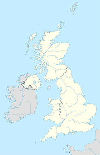
Location on the map of United Kingdom
Cambridge
City hall
Clare College Great Hall
Cambridge
City hall
read more
Clothing store
Kew
10 Downing Street, Cambridge
Clothing store
read more
Laird Hatters
4 Green Street, Cambridge
Clothing store
read more
Ellis Brigham Mountain Sports
45, Lion Yard Shopping Centre, Petty Cury, Cambridge
Clothing store
read more
Zakti Active
36 Sidney Street, Cambridge
Clothing store
read more
Radley
2, Saint Andrew's Street, Cambridge
Clothing store
read more
Ryder & Amies
22 King's Parade, Cambridge
Clothing store
read more
Cath Kidston
31-33 Market Hill, Cambridge
Clothing store
read more
The Perfume Shop Cambridge
25 Petty Cury, Cambridge
Clothing store
read more
Oliver Bonas
30 Sidney Street, Cambridge
Clothing store
read more
Jo Malone London
14 Rose Crescent, Cambridge
Clothing store
read more
Noa Noa
15 Kings Parade, Cambridge
Clothing store
read more
Tesco Clothing Click and Collect
63 Riverside Place, Cambridge
Clothing store
read more
Phase Eight Fashion & Design Ltd
John Lewis, 62-74 Burley Street, Cambridge
Clothing store
read more
Hollister Co.
Saint Andrew's Street, Cambridge
Clothing store
read more
Disney Store Pop Up Cambridge
Unit 40, Grand Arcade Saint Andrew's Street, Cambridge
Clothing store
read more
Convenience store
Balv's Superette
158 Mill Road, Cambridge
Convenience store
read more
Sainsbury's Local
78/80 Mill Rd, Cambridge
Convenience store
read more
Londis
38 High Street, Cambridge
Convenience store
read more
One Stop Stores
43-47 Ditton Lane, Cambridge
Convenience store
read more
Al Noor Grocers
1C Arbury Road, Cambridge
Convenience store
read more
One Stop
301 Mill Road, Cambridge
Convenience store
read more
Sainsbury's
Station Road On The Square, Cambridge
Convenience store
read more
Co-op Food - Ailsa Court
179-185 Chesterton Road, Cambridge
Convenience store
read more
Amigo
Cambridge University Hospitals NHS Foundation Trust, Hills Road, Cambridge
Convenience store
read more
One Stop
301-305 Mill Rd, Cambridge
Convenience store
read more
McColl's
187 Histon Road, Cambridge
Convenience store
read more
Denizler Ltd
28 Mill Road, Cambridge
Convenience store
read more
Trumpington Food & Wine
150 Shelford Road, Cambridge
Convenience store
read more
Co-op Food - Milton Road
129 Milton Road, Cambridge
Convenience store
read more
Cambridge Butchers Cousins
36 Grantchester Street, Cambridge
Convenience store
read more
Transit station
Veterinary School
United Kingdom
Transit station
read more
Drummer Street
United Kingdom
Transit station
read more
Queens' College
United Kingdom
Transit station
read more
John Conder Court
United Kingdom
Transit station
read more
The Busway Regional College
United Kingdom
Transit station
read more
Emmanuel Street
United Kingdom
Transit station
read more
Ascham Road
United Kingdom
Transit station
read more
St Andrew's Street
United Kingdom
Transit station
read more
Bank
NatWest
56 Saint Andrew's Street, Cambridge
Bank
read more
Barclays Bank
7-8 Clifton Court, Cherry Hinton Road, Cambridge
Bank
read more
HSBC
62 Hills Road, Cambridge
Bank
read more
TSB Bank
6 Saint Andrew's Street, Cambridge
Bank
read more
Lloyds Bank
125 Chesterton Road, Cambridge
Bank
read more
Virgin Money
26-27 Sidney Street, Cambridge
Bank
read more
Santander
60 St. Andrews Street, Cambridge
Bank
read more
RBS
28 Trinity Street, Cambridge, Cambridgeshire, Cambridge
Bank
read more
NatWest
36 Fitzroy Street, Cambridge
Bank
read more
Lloyds Bank
78-80 Cherry Hinton Rd, Cambridge
Bank
read more
MoneyGram
Cambridgeshire Guided Busway, Cambridge
Bank
read more
NatWest
23 Market Street, Cambridge
Bank
read more
Metro Bank
1 Christ's Lane, Cambridge
Bank
read more
TSB Bank
6 St Andrews Street, Cambridge
Bank
read more
Lloyds Bank
3 Sidney Street, Cambridge
Bank
read more
📑
Cambridge all categories
Accounting
Administrative area level 2
Airport
Art gallery
Atm
Bakery
Bank
Bar
Beauty salon
Bicycle store
Book store
Bowling alley
Bus station
Cafe
Campground
Car dealer
Car rental
Car repair
Car wash
Casino
Cemetery
Church
City hall
Clothing store
Convenience store
Courthouse
Dentist
Department store
Doctor
Electrician
Electronics store
Finance
Fire station
Florist
Food
Funeral home
Furniture store
Gas station
General contractor
Grocery or supermarket
Gym
Hair care
Hardware store
Health
Home goods store
Hospital
Insurance agency
Jewelry store
Laundry
Lawyer
Library
Liquor store
Local government office
Locality
Locksmith
Lodging
Meal delivery
Meal takeaway
Mosque
Movie rental
Movie theater
Moving company
Museum
Natural feature
Neighborhood
Night club
Painter
Park
Parking
Pet store
Pharmacy
Physiotherapist
Place of worship
Plumber
Point of interest
Police
Post office
Premise
Real estate agency
Restaurant
Roofing contractor
Route
School
Shoe store
Shopping mall
Spa
Stadium
Storage
Store
Subpremise
Supermarket
Synagogue
Train station
Transit station
Travel agency
University
Veterinary care
administrative area level 3
administrative area level 4
sublocality level 1
↑