Convenience store nearby McColl's
United Kingdom
Convenience store nearby McColl's
McColl's
22 Market Square, Bicester United Kingdom
contacts phone
:
+44
Latitude:
51.8968363
, Longitude:
-1.1514837
read more
nearest Convenience store
49 m
Bicester Food N Wine
13 Manorsfield Road, Bicester
Convenience store
read more
133 m
Martin's
22 Sheep Street, Bicester
Convenience store
read more
855 m
SPAR
Oxford Road, Bicester
Convenience store
read more
976 m
McColl's
58 Villiers Road, Bicester
Convenience store
read more
1.07 km
Co-op Food
9 Bassett Avenue, Bicester
Convenience store
read more
1.185 km
Midcounties Co-operative
Audley House, Buckingham Road, Bicester
Convenience store
read more
1.2 km
The Cooperative Food
Buckingham Road, Bicester
Convenience store
read more
1.743 km
Co-op Food - Bicester
1-3 Kingsley Road, Bicester
Convenience store
read more
12.558 km
McColl's
3 High Street, Kidlington
Convenience store
read more
12.589 km
The Midcounties Co-operative
199 Banbury Road, Oxford, Kidlington
Convenience store
read more
12.6 km
The Co-operative Food
108 Oxford Rd, Kidlington
Convenience store
read more
13.026 km
Grovelands Convenience Store
United Kingdom
Convenience store
read more
14.207 km
OX2 Convenience store
1-3 Kendall Crescent, Oxford
Convenience store
read more
14.4 km
Fraser's Budgens of Yarnton
93 Woodstock Road, Yarnton, Kidlington
Convenience store
read more
14.709 km
SPAR Headington
10-12 Underhill Circus, Oxford
Convenience store
read more
14.776 km
Wootton Stores Ltd
Church Street, Woodstock
Convenience store
read more
14.949 km
The Co-operative Food
38-40 High Street, Woodstock
Convenience store
read more
15.344 km
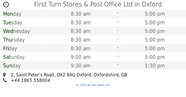
First Turn Stores & Post Office Ltd
2 Saint Peter's Road, Oxford
Convenience store
read more
15.348 km
Co-op Food - Cherwell Drive
22 Cherwell Drive, Oxford
Convenience store
read more
15.541 km
Salford Store
15 Salford Road, Oxford
Convenience store
read more
15.738 km
The Post Box
82 Godstow Road, Oxford
Convenience store
read more
16.012 km
West Street Local
28 West Street, Buckingham
Convenience store
read more
16.303 km
Co-op Food
45 Richmond Street, King's Sutton, Banbury
Convenience store
read more
16.455 km
The Hayfield Deli
4-6 Hayfield Road, Oxford
Convenience store
read more
16.824 km
East West Provisions
61A Woodstock Road, Oxford
Convenience store
read more
📑
all categories
Accounting
Administrative area level 1
Administrative area level 2
Airport
Amusement park
Aquarium
Art gallery
Atm
Bakery
Bank
Bar
Beauty salon
Bicycle store
Book store
Bowling alley
Bus station
Cafe
Campground
Car dealer
Car rental
Car repair
Car wash
Casino
Cemetery
Church
City hall
Clothing store
Colloquial area
Convenience store
Courthouse
Dentist
Department store
Doctor
Electrician
Electronics store
Embassy
Establishment
Finance
Fire station
Florist
Food
Funeral home
Furniture store
Gas station
General contractor
Grocery or supermarket
Gym
Hair care
Hardware store
Health
Hindu Temple
Home goods store
Hospital
Insurance agency
Jewelry store
Laundry
Lawyer
Library
Light rail station
Liquor store
Local government office
Locality
Locksmith
Lodging
Meal delivery
Meal takeaway
Mosque
Movie rental
Movie theater
Moving company
Museum
Natural feature
Neighborhood
Night club
Painter
Park
Parking
Pet store
Pharmacy
Physiotherapist
Place of worship
Plumber
Point of interest
Police
Political
Post office
Premise
Real estate agency
Restaurant
Roofing contractor
Route
Rv park, camping
School
Shoe store
Shopping mall
Spa
Stadium
Storage
Store
Subpremise
Subway station
Supermarket
Synagogue
Taxi stand
Train station
Transit station
Travel agency
University
Veterinary care
Zoo
administrative area level 3
administrative area level 4
sublocality level 1
↑