places in Coventry
United Kingdom
Coventry
Coventry
Administrative Region:
England
population:
344 322
calling code:
+44-24
postcode:
CV1-CV8
Location on the map of United Kingdom
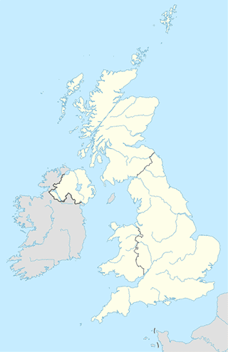
Coventry
Courthouse
Coventry Combined Court Centre
Much Park Street, Coventry
Courthouse
read more
Coventry Combined Court
Coventry
Courthouse
read more
Coventry Magistrates' Court
Little Park Street, Coventry, West Midlands
Courthouse
read more
Coventry Villagebuzz
1 Priory Street, Coventry
Courthouse
read more
Victim Support Servcice
15 Little Park Street, Coventry
Courthouse
read more
Library
Aldermoor Library
Acorn Street, Coventry
Library
read more
Islamic Academy of Coventry
83-87 Cambridge Street, Hillfields, Coventry
Library
read more
Beyond the Box Resources
The Reform Club, 5, Warwick Row, Coventry
Library
read more
Lanchester Library
Frederick Lanchester Building, Coventry University, Gosford Street, Coventry
Library
read more
National Police Library
College of Policing, Leamington Road, Ryton-on-Dunsmore, Coventry
Library
read more
Hillfields Library
WATCH Centre, Victoria Street, Coventry
Library
read more
Cheylesmore Library
Cheylesmore Community Centre, Poitiers Road, Coventry
Library
read more
Coundon Library
Moseley Avenue, Coventry
Library
read more
Central Library
Smithford Way, Coventry
Library
read more
Cheylesmore Community Centre
Poitiers Rd, Cheylesmore, Coventry
Library
read more
Bell Green Library
Riley Square, Coventry
Library
read more
Canley Library
Prior Deram Walk, Coventry
Library
read more
Earlsdon Library
Earlsdon Avenue North, Coventry
Library
read more
Stoke Library
Kingsway, Coventry
Library
read more
Holbrooks Library
Holbrooks Community Care Association, Holbrook Lane, Coventry
Library
read more
Shoe store
Skatehut Coventry
21 The Burges, Coventry
Shoe store
read more
Sports Direct
6A, Central Six Retail Park, Warwick Road, Coventry
Shoe store
read more
Foot Locker
19 The Precinct, Coventry
Shoe store
read more
Technology in Motion - Coventry
12 Park Road, Coventry
Shoe store
read more
Quiz Clothing
Unit 77, Lower Precinct Shopping Centre, Coventry
Shoe store
read more
Footasylum Coventry - West Orchards Shopping Centre
20, West Orchards Shopping Centre, Ford Street, Coventry
Shoe store
read more
Sports Direct
15- 18 Cannon Park Rd Unit 15 18 Cannon Park,, Lynchgate Road, Coventry
Shoe store
read more
Chameleon Menswear
West Orchard Shopping Centre, Smithford Way, Coventry
Shoe store
read more
JD Sports
Cathedral Lanes Shopping Centre, 60-64 Broadgate, Coventry
Shoe store
read more
Shoe Closet
Upper Precinct, Coventry
Shoe store
read more
Shuropody Coventry
28, West Orchards Shopping Centre, Coventry
Shoe store
read more
schuh
Shopping Centre, 68-72 Lower Precinct, Coventry
Shoe store
read more
JD Sports
40-44, 38 The Precinct, Coventry
Shoe store
read more
Shoe Kings
Retail Market, Queen Victoria Road, Coventry
Shoe store
read more
www.konstanceshoes.co.uk
41 Randle Street, Coventry
Shoe store
read more
Atm
ATM
1, Gramercy Park, Coventry
Atm
read more
ATM
38-40 Prior Deram Walk, Coventry
Atm
read more
ATM (The Burnt Post)
Kenpas Highway, Coventry
Atm
read more
ATM
Alvis Retail Park, Holyhead Road, Coventry
Atm
read more
Landmark Bitcoin ATM | Coventry
174 Clay Lane, Coventry
Atm
read more
ATM (Post Office)
82 Baginton Road, Coventry
Atm
read more
ATM
Post Office, 485 Binley Road, Coventry
Atm
read more
ATM
127 Terry Road, Coventry
Atm
read more
ATM, European Mini Market
153 Far Gosford Street, Coventry
Atm
read more
ATM
177 Hearsall Lane, Coventry
Atm
read more
ATM
52 Holbrook Lane, Coventry
Atm
read more
ATM
21 Cromwell Street, Coventry
Atm
read more
ATM
Rugby Road, Willenhall Lane, Rugby
Atm
read more
ATM HSBC
5-6, High Street, Coventry
Atm
read more
ATM
158 Broomfield Road, Coventry
Atm
read more
City hall
Bubbenhall Village Hall
Lower End, Coventry
City hall
read more
Ryton on Dunsmore Village Hall
High Street, Ryton-on-Dunsmore, Coventry
City hall
read more
📑
Coventry all categories
Accounting
Airport
Aquarium
Art gallery
Atm
Bakery
Bank
Bar
Beauty salon
Bicycle store
Book store
Bus station
Cafe
Campground
Car dealer
Car rental
Car repair
Car wash
Casino
Cemetery
Church
City hall
Clothing store
Convenience store
Courthouse
Dentist
Department store
Doctor
Electrician
Electronics store
Finance
Fire station
Florist
Food
Funeral home
Furniture store
Gas station
General contractor
Grocery or supermarket
Gym
Hair care
Hardware store
Health
Hindu Temple
Home goods store
Hospital
Insurance agency
Jewelry store
Laundry
Lawyer
Library
Liquor store
Local government office
Locality
Locksmith
Lodging
Meal delivery
Meal takeaway
Mosque
Movie rental
Movie theater
Moving company
Museum
Natural feature
Neighborhood
Night club
Painter
Park
Parking
Pet store
Pharmacy
Physiotherapist
Place of worship
Plumber
Point of interest
Police
Post office
Premise
Real estate agency
Restaurant
Roofing contractor
Route
Rv park, camping
School
Shoe store
Shopping mall
Spa
Stadium
Storage
Store
Subpremise
Supermarket
Taxi stand
Train station
Transit station
Travel agency
University
Veterinary care
administrative area level 3
sublocality level 1
↑