places in Derby
United Kingdom
Derby
Derby
Administrative Region:
England
population:
275 599
calling code:
+44-1332
postcode:
DE1
DE3
DE21-24
DE65
DE72-DE74
DE99
Location on the map of United Kingdom
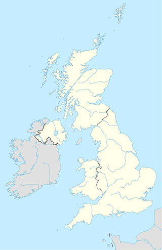
Derby
administrative area level 4
Mackworth
Reino Unido
administrative area level 4
read more
Mackworth
Det Forenede Kongerige
administrative area level 4
read more
Mackworth
United Kingdom
administrative area level 4
read more
Bus station
Babington Lane (Stop A10)
United Kingdom
Bus station
read more
Anglers Arms
United Kingdom
Bus station
read more
The Strand (Stop B14)
United Kingdom
Bus station
read more
Bold Lane (Stop B13)
United Kingdom
Bus station
read more
Charnwood Street
United Kingdom
Bus station
read more
Corporation Street (Stop C3)
United Kingdom
Bus station
read more
Crown Derby
United Kingdom
Bus station
read more
Grayburn Avenue
United Kingdom
Bus station
read more
The Bonnie Prince
United Kingdom
Bus station
read more
Cavendish Way
United Kingdom
Bus station
read more
Derwent Street (Stop C9)
United Kingdom
Bus station
read more
Burley Lane
United Kingdom
Bus station
read more
Chellaston School
United Kingdom
Bus station
read more
Spencer Street
United Kingdom
Bus station
read more
Corporation Street (Stop C2)
United Kingdom
Bus station
read more
Grocery or supermarket
Realthai Thaifoods
42a Eagle Centre Market, Derby
Grocery or supermarket
read more
Ideal Sweets
279 Normanton Road, Derby
Grocery or supermarket
read more
Chester Green News Off-Licence & Grocery
Caesar Street, Derby
Grocery or supermarket
read more
Londis
3 Traffic Street, Derby
Grocery or supermarket
read more
Farmfoods Ltd
Ascot Drive, Allenton, Derby, Derby - Allenton
Grocery or supermarket
read more
Allenton Local Sweets Snacks
United Kingdom
Grocery or supermarket
read more
Delton Foods
Walbrook Road, Derby
Grocery or supermarket
read more
Arthur's Superstore
40 Arthur Street, Derby
Grocery or supermarket
read more
ZEE ZEE NEWS
265 Osmaston Road, Derby
Grocery or supermarket
read more
Puri Food Store
6-8 Stenson Road, Derby
Grocery or supermarket
read more
Farmfoods Ltd
22/24 Albert Street, Derby
Grocery or supermarket
read more
Sharif and Sons Supermarket
Derby
Grocery or supermarket
read more
Aldi Burton Road
Burton Road, Derby
Grocery or supermarket
read more
Derby
81, Wetherby Road, Derby
Grocery or supermarket
read more
Alfie salad
Grocery or supermarket
read more
Library
Sinfin Library
District Centre, Arleston Lane, Derby
Library
read more
bitcoin
82 Leacroft Road, Derby
Library
read more
Pear Tree Library
159 Pear Tree Road, Derby
Library
read more
Allenton Library
Poole Street, Derby
Library
read more
Cahnegie Library
17 Portland Street, Derby
Library
read more
Chellaston Library
Barley Croft, Derby
Library
read more
Mickleover Carers Group
Holly End Road, Derby
Library
read more
Alvaston Library and Learning Centre
1252 London Road, Derby
Library
read more
Mickleover Carers Group
3 Holly End Road, Derby
Library
read more
Royal Derby Hospital Library
Education Centre, 2, Uttoxeter Road, Derby
Library
read more
Mickleover Library
Holly End Road, Derby
Library
read more
Derwent Community Library
Revive Healthy Living Centre, Roe Farm Lane, Derby
Library
read more
Blagreaves Library
253 Blagreaves Lane, Derby
Library
read more
School Library Service
184 Kedleston Road, Derby
Library
read more
Spondon Library
Sitwell Street, Derby
Library
read more
Casino
Quicksilver
1a, Central Hall, Exchange Street, Derby
Casino
read more
Genting Casino Riverlights
Derby Riverlights, Morledge, Derby
Casino
read more
📑
Derby all categories
Accounting
Administrative area level 2
Airport
Aquarium
Art gallery
Atm
Bakery
Bank
Bar
Beauty salon
Bicycle store
Book store
Bowling alley
Bus station
Cafe
Campground
Car dealer
Car rental
Car repair
Car wash
Casino
Cemetery
Church
Clothing store
Convenience store
Courthouse
Dentist
Department store
Doctor
Electrician
Electronics store
Embassy
Finance
Fire station
Florist
Food
Funeral home
Furniture store
Gas station
General contractor
Grocery or supermarket
Gym
Hair care
Hardware store
Health
Hindu Temple
Home goods store
Hospital
Insurance agency
Jewelry store
Laundry
Lawyer
Library
Liquor store
Local government office
Locality
Locksmith
Lodging
Meal delivery
Meal takeaway
Mosque
Movie rental
Movie theater
Moving company
Museum
Natural feature
Neighborhood
Night club
Painter
Park
Parking
Pet store
Pharmacy
Physiotherapist
Place of worship
Plumber
Point of interest
Police
Post office
Premise
Real estate agency
Restaurant
Roofing contractor
Route
Rv park, camping
School
Shoe store
Shopping mall
Spa
Stadium
Storage
Store
Subpremise
Supermarket
Taxi stand
Train station
Transit station
Travel agency
University
Veterinary care
Zoo
administrative area level 4
sublocality level 1
↑