places in Durham
United Kingdom
Durham
Durham
Administrative Region:
England
population:
50 515
calling code:
+44-191
postcode:
DH1
DH6-DH8
DH97-DH99
Location on the map of United Kingdom
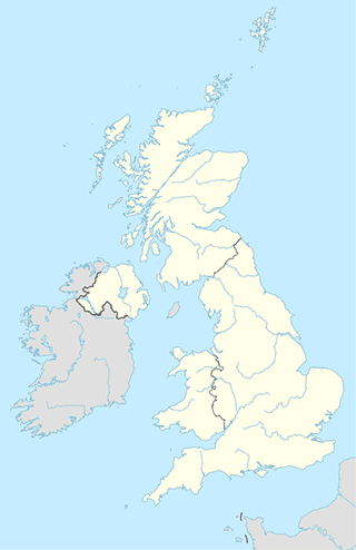
Durham
Police
Durham Constabulary
Durham
Police
read more
Durham Police - Framwellgate Police Office
Finchale Road, Durham
Police
read more
Durham Police Public Order Training
Meadowfield, Durham
Police
read more
Durham Constabulary - Durham City Police Station
New Elvet, Durham
Police
read more
Durham Police - Sacriston Police Station
Plawsworth Road, Sacriston, Durham
Police
read more
Gilesgate Police Station
133 Sherburn Road, Durham
Police
read more
Durham Police Federation
5, Kingfisher House, Saint John's Road, Meadowfield
Police
read more
School
Durham Johnston
Crossgate Moor, Durham
School
read more
Durham City Saturday School
56 Claypath, Durham
School
read more
Ustinov College Sheraton Park
Durham
School
read more
St Margarets C E Primary School
Crossgate Peth, Durham
School
read more
Joetaiji
Durham
School
read more
Ogden Centre West Department of Physics, Durham University
Department of Physics, Durham University, South Road, Durham
School
read more
St Oswald's Sunshine Club
19D Church Street, Durham
School
read more
Language Centre
81 New Elvet, Durham
School
read more
Department Of Physics
Mountjoy Site, 3le, South Road, Durham
School
read more
Saint Oswald's Church of England Infant and Nursery School
4 Church Street, Durham
School
read more
Durham Sixth Form Centre
The Sands, Durham
School
read more
Anderson's Digital Music
15 Grape Lane, Durham
School
read more
The Chorister School
The College, Durham, DH1 3EL
School
read more
Durham University Day Nursery
Haworth Building, Leazes Road, Durham
School
read more
St Oswald's Church of England Aided Primary & Nursery School
Church Street, Durham
School
read more
Store
Thorntons
Su36 High Street, The Land Of Prince Bishops, Durham
Store
read more
EE
13/15 Silver Street, Durham
Store
read more
Scope
8 North Road, Durham
Store
read more
Moon Jewellery
12 Silver Street, Durham
Store
read more
Vaporized
23 Silver Street, Durham
Store
read more
Paperchase
Unit 10, Prince Bishops Shopping Centre, High Street, Durham
Store
read more
Buzzin Guns
6 Neville Street, Durham
Store
read more
M I Dickson Ltd.
69 North Road, Durham
Store
read more
Alastair Wade Optometrists
8 Saddler Street, Durham
Store
read more
Screwfix
45, Dragonville Industrial Park, Dragon Lane, Durham
Store
read more
Fish Alive
2 Dragonville Court, Durham
Store
read more
Card Factory
2 Dragonville Court, Durham
Store
read more
Act Packaging
Unit 8C, Rennys Lane, Durham
Store
read more
Meeple Games
52 North Road, Durham
Store
read more
Salvation Army
62 North Road, Durham
Store
read more
Atm
R & B Convenience Store ( Premier )
News Building, Broom Lane, Ushaw Moor
Atm
read more
ATM
3 North Road, Durham
Atm
read more
ATM (Bill Free Homes - New Elvet)
85 Elvet Bridge, Durham
Atm
read more
Sainsbury's Bank ATM
12 Lyndhurst Drive, Durham
Atm
read more
ATM
17 North Road, Durham
Atm
read more
Nationwide
9 Market Place, Durham
Atm
read more
ATM
4 Front Street, New Durham, Durham
Atm
read more
ATM (Loveshack)
Unit 3, Durham
Atm
read more
ATM
Wheatlands Way, Durham
Atm
read more
Barclays ATM
Durham Train Station, North Road, Durham Station
Atm
read more
ATM
Durham County Hall, Durham County Council County Hall, Durham
Atm
read more
Santander ATM
3 Framwelgate, Durham
Atm
read more
ATM (Sainsburys)
Newcastle Road, Durham
Atm
read more
ATM
18 Alnwick Road, Durham
Atm
read more
ATM Charges £1.85
84-85 New Elvet, Durham
Atm
read more
Campground
Durham Grange Caravan and Motorhome Club Site
Meadow Lane, Durham
Campground
read more
Low Carrs Residential Park
Durham
Campground
read more
Woodside Ridge Caravan Park
Kelloe, Trimdon Station
Campground
read more
ideal caravans
Littleburn Lane, Langley Moor
Campground
read more
Durham Grange Caravan and Motorhome Club Site
Meadow Lane, County Durham
Campground
read more
📑
Durham all categories
Accounting
Airport
Amusement park
Art gallery
Atm
Bakery
Bank
Bar
Beauty salon
Bicycle store
Book store
Bus station
Cafe
Campground
Car dealer
Car rental
Car repair
Car wash
Casino
Cemetery
Church
City hall
Clothing store
Colloquial area
Convenience store
Courthouse
Dentist
Department store
Doctor
Electrician
Electronics store
Finance
Fire station
Florist
Food
Funeral home
Furniture store
Gas station
General contractor
Grocery or supermarket
Gym
Hair care
Hardware store
Health
Home goods store
Hospital
Insurance agency
Jewelry store
Laundry
Lawyer
Library
Liquor store
Local government office
Locality
Locksmith
Lodging
Meal delivery
Meal takeaway
Mosque
Movie rental
Movie theater
Moving company
Museum
Natural feature
Neighborhood
Night club
Painter
Park
Parking
Pet store
Pharmacy
Physiotherapist
Place of worship
Plumber
Point of interest
Police
Post office
Premise
Real estate agency
Restaurant
Roofing contractor
Route
Rv park, camping
School
Shoe store
Shopping mall
Spa
Storage
Store
Supermarket
Taxi stand
Train station
Transit station
Travel agency
University
Veterinary care
administrative area level 4
sublocality level 1
↑