Gas station nearby Asda Petrol
United Kingdom
Gas station nearby Asda Petrol
Asda Petrol
Highwood Lane, BS34 5TQ, Patchway, South Gloucestershire, GB United Kingdom
contacts phone
:
+44
Latitude:
51.5296018
, Longitude:
-2.5995165
larger map & directions
read more
nearest Gas station
4 m
Asda Petrol
Bristol
Gas station
read more
443 m
Morrisons Petrol Station
Lysander Road, Bristol, Somerset
Gas station
read more
1.715 km
Shell Cribbs Causeway
Cribbs Causeway, Bristol
Gas station
read more
1.992 km
Esso
73-75 Gloucester Road North, Bristol
Gas station
read more
2.116 km
Esso
184 Gloucester Road, Bristol
Gas station
read more
2.324 km
Texaco
191 Gloucester Road, Patchway, Bristol
Gas station
read more
3.529 km
Tesco Extra Bradley Stoke
Bradley Stoke, Bristol
Gas station
read more
3.534 km
Tesco Petrol Station
Office, 2A The Mall, Bradley Stoke, Bristol
Gas station
read more
4.061 km
Marks & Spencer Falcondale BP
Falcondale Road, Bristol
Gas station
read more
4.063 km
BP
Falcondale Road, Bristol
Gas station
read more
4.063 km
BP
135 Falcondale Road, Bristol
Gas station
read more
4.114 km
Sainsbury's Petrol Station
Fox Den Road, Stoke Gifford, Bristol
Gas station
read more
4.743 km
Pilning Garage
5 Cross Hands Road, Pilning, Bristol
Gas station
read more
4.869 km
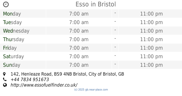
Esso
142 Henleaze Road, Bristol
Gas station
read more
5.058 km
Shell
410-422 Gloucester Road, Bristol
Gas station
read more
5.058 km
Gloucester Road Service Station
410-422 Gloucester Road, Bristol
Gas station
read more
5.134 km
BP
Gloucester Road, Bristol
Gas station
read more
5.136 km
BP
Gloucester Rd, Bristol
Gas station
read more
5.936 km
Texaco
Park Road, Stapleton, Bristol
Gas station
read more
5.937 km
Murco
B4058, Bristol
Gas station
read more
5.969 km
20
22 Failand Crescent, Bristol
Gas station
read more
6.057 km
BP
213 Frenchay Park Road, Bristol
Gas station
read more
8.023 km
Shell
Badminton Road, Bristol
Gas station
read more
9.37 km
Asda Petrol
East Street, Bristol
Gas station
read more
14.36 km
Esso
Clevedon Road, Nailsea, Bristol
Gas station
read more
📑
all categories
Accounting
Administrative area level 1
Administrative area level 2
Airport
Amusement park
Aquarium
Art gallery
Atm
Bakery
Bank
Bar
Beauty salon
Bicycle store
Book store
Bowling alley
Bus station
Cafe
Campground
Car dealer
Car rental
Car repair
Car wash
Casino
Cemetery
Church
City hall
Clothing store
Colloquial area
Convenience store
Courthouse
Dentist
Department store
Doctor
Electrician
Electronics store
Embassy
Establishment
Finance
Fire station
Florist
Food
Funeral home
Furniture store
Gas station
General contractor
Grocery or supermarket
Gym
Hair care
Hardware store
Health
Hindu Temple
Home goods store
Hospital
Insurance agency
Jewelry store
Laundry
Lawyer
Library
Light rail station
Liquor store
Local government office
Locality
Locksmith
Lodging
Meal delivery
Meal takeaway
Mosque
Movie rental
Movie theater
Moving company
Museum
Natural feature
Neighborhood
Night club
Painter
Park
Parking
Pet store
Pharmacy
Physiotherapist
Place of worship
Plumber
Point of interest
Police
Political
Post office
Premise
Real estate agency
Restaurant
Roofing contractor
Route
Rv park, camping
School
Shoe store
Shopping mall
Spa
Stadium
Storage
Store
Subpremise
Subway station
Supermarket
Synagogue
Taxi stand
Train station
Transit station
Travel agency
University
Veterinary care
Zoo
administrative area level 3
administrative area level 4
sublocality level 1
↑