Gas station nearby Dunnings Bridge Filling Station
United Kingdom
Gas station nearby Dunnings Bridge Filling Station
Dunnings Bridge Filling Station
Merseyside, Dunnings Bridge Road, Bootle Det Forenede Kongerige
contacts phone
:
+44
Latitude:
53.4823063
, Longitude:
-2.9662229
read more
nearest Gas station
18 m
D B Garages
Dunnings Bridge Road, Bootle
Gas station
read more
26 m
Gulf Dunnings Bridge Filling Station
Dunnings Bridge Road, Bootle
Gas station
read more
236 m
Park Lane Filling Station
Park Lane West, Netherton
Gas station
read more
1.435 km
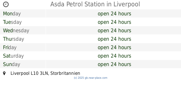
Asda Petrol Station
Liverpool
Gas station
read more
1.628 km
Asda Petrol
47 Orrell Lane, Bootle
Gas station
read more
1.835 km
BP
48 Hall Lane, Liverpool
Gas station
read more
2.654 km
Tesco Petrol Station
Hawthorne Road, Litherland, Liverpool
Gas station
read more
2.883 km
Shell
13 Linacre Lane, Bootle
Gas station
read more
3.028 km
BP
Long Lane, Liverpool
Gas station
read more
3.075 km
J H S Premiere
3 Aintree Rd, Bootle
Gas station
read more
3.737 km
Esso
Northway, Liverpool
Gas station
read more
3.747 km
Maghull Service Station
Maghull Self Service, Northway, Maghull, Liverpool
Gas station
read more
3.919 km
AS24
Crosby Road South, Liverpool
Gas station
read more
4.003 km
BP
Whitefield Drive, Liverpool
Gas station
read more
4.33 km
BP
East Lancashire Road, Liverpool
Gas station
read more
4.333 km
Esso
CROSBY, College Road, Brighton le Sands, Liverpool
Gas station
read more
4.503 km
Shell
100 Derby Road, Liverpool
Gas station
read more
4.503 km
Shell Derby Road
100 Derby Road, Liverpool
Gas station
read more
4.504 km
Shell
74-80 Derby Road, Liverpool, Bootle
Gas station
read more
4.51 km
Shell Select
100 Derby Road, Bootle
Gas station
read more
4.835 km
Shell Maghull
Northway, Maghull
Gas station
read more
4.93 km
Asda Petrol
Asda Walton Superstore, Utting Avenue, Liverpool
Gas station
read more
4.952 km
Mount Garage
Prescot Road, Melling, Liverpool
Gas station
read more
4.956 km
Gulf Mount Garage
The Mount, Liverpool
Gas station
read more
4.965 km
Gulf
Bank Lane, Liverpool
Gas station
read more
📑
all categories
Accounting
Administrative area level 1
Administrative area level 2
Airport
Amusement park
Aquarium
Art gallery
Atm
Bakery
Bank
Bar
Beauty salon
Bicycle store
Book store
Bowling alley
Bus station
Cafe
Campground
Car dealer
Car rental
Car repair
Car wash
Casino
Cemetery
Church
City hall
Clothing store
Colloquial area
Convenience store
Courthouse
Dentist
Department store
Doctor
Electrician
Electronics store
Embassy
Establishment
Finance
Fire station
Florist
Food
Funeral home
Furniture store
Gas station
General contractor
Grocery or supermarket
Gym
Hair care
Hardware store
Health
Hindu Temple
Home goods store
Hospital
Insurance agency
Jewelry store
Laundry
Lawyer
Library
Light rail station
Liquor store
Local government office
Locality
Locksmith
Lodging
Meal delivery
Meal takeaway
Mosque
Movie rental
Movie theater
Moving company
Museum
Natural feature
Neighborhood
Night club
Painter
Park
Parking
Pet store
Pharmacy
Physiotherapist
Place of worship
Plumber
Point of interest
Police
Political
Post office
Premise
Real estate agency
Restaurant
Roofing contractor
Route
Rv park, camping
School
Shoe store
Shopping mall
Spa
Stadium
Storage
Store
Subpremise
Subway station
Supermarket
Synagogue
Taxi stand
Train station
Transit station
Travel agency
University
Veterinary care
Zoo
administrative area level 3
administrative area level 4
sublocality level 1
↑