Lodging nearby Nolands Farm
United Kingdom
Lodging nearby Nolands Farm
Nolands Farm
Oxhill, Warrick, Warwick Vereinigtes Königreich
contacts phone
:
+44
Latitude:
52.1205964
, Longitude:
-1.5444726
read more
nearest Lodging
1.306 km
Manor Cottage
Manor Cottage, Beech Road, Oxhill
Lodging
read more
1.464 km
Stable Croft
Greenfields, Green Lane, Oxhill, Warwick
Lodging
read more
1.81 km
Roman Acres Cottage
Pillerton Hersey, Roman Acres, Pillerton Hersey
Lodging
read more
3.151 km
Fulready Manor
Fulready, Stratford-upon-Avon
Lodging
read more
3.46 km
Stamford Hall
Fosse Way, Stratford-upon-Avon
Lodging
read more
3.78 km
The Old Coach House
Kineton
Lodging
read more
4.096 km
Ettington Chase
Banbury Road, Ettington
Lodging
read more
4.106 km
Tysoe Manor
Shipston Road, Upper Tysoe, Warwick
Lodging
read more
4.445 km
Lockwood House
Shepherd Place, Kineton
Lodging
read more
4.512 km
Lockwood House
Lockwood House, Shepherd Place, Kineton
Lodging
read more
4.518 km
Old Lodge Farm
Sugarswell Lane, Edgehill, Banbury
Lodging
read more
4.616 km
The Swan Hotel
Banbury Street, Kineton, Warwick
Lodging
read more
4.641 km
JOSEPHS AMAZING CAMELS LTD.
2 White House Farm Cottages, Idlicote, Shipston-on-Stour
Lodging
read more
4.908 km
Red House Barn
Kineton, Warwick
Lodging
read more
7.293 km
April Cottage
The Green, Shenington, Banbury
Lodging
read more
9.791 km
The White House, Bed and Breakfast
The White House, Burton Dassett, Southam
Lodging
read more
10.938 km
Days Inn Warwick services North
Chesterton and Kingston
Lodging
read more
10.997 km
Greenlands Cottages
3 Greenlands Cottages, Ashorne, Warwick
Lodging
read more
12.21 km
River Reach
Alveston, Stratford-upon-Avon
Lodging
read more
12.602 km
Great Thatch
1hn, 6 Main Street, Banbury
Lodging
read more
13.811 km
Braeside
26 Temple End, Harbury, Leamington Spa
Lodging
read more
14.346 km
Red House Farm
Banbury Road, Bishop's Tachbrook, Leamington Spa
Lodging
read more
14.388 km
Cropredy Lawn
Cropredy Lawn, Cropredy, Banbury
Lodging
read more
15.817 km
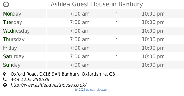
Ashlea Guest House
Ashlea Guest House, 58, Oxford Road, Banbury
Lodging
read more
17.352 km
Henbury Lodge
Broad Gap, Bodicote, Banbury
Lodging
read more
📑
all categories
Accounting
Administrative area level 1
Administrative area level 2
Airport
Amusement park
Aquarium
Art gallery
Atm
Bakery
Bank
Bar
Beauty salon
Bicycle store
Book store
Bowling alley
Bus station
Cafe
Campground
Car dealer
Car rental
Car repair
Car wash
Casino
Cemetery
Church
City hall
Clothing store
Colloquial area
Convenience store
Courthouse
Dentist
Department store
Doctor
Electrician
Electronics store
Embassy
Establishment
Finance
Fire station
Florist
Food
Funeral home
Furniture store
Gas station
General contractor
Grocery or supermarket
Gym
Hair care
Hardware store
Health
Hindu Temple
Home goods store
Hospital
Insurance agency
Jewelry store
Laundry
Lawyer
Library
Light rail station
Liquor store
Local government office
Locality
Locksmith
Lodging
Meal delivery
Meal takeaway
Mosque
Movie rental
Movie theater
Moving company
Museum
Natural feature
Neighborhood
Night club
Painter
Park
Parking
Pet store
Pharmacy
Physiotherapist
Place of worship
Plumber
Point of interest
Police
Political
Post office
Premise
Real estate agency
Restaurant
Roofing contractor
Route
Rv park, camping
School
Shoe store
Shopping mall
Spa
Stadium
Storage
Store
Subpremise
Subway station
Supermarket
Synagogue
Taxi stand
Train station
Transit station
Travel agency
University
Veterinary care
Zoo
administrative area level 3
administrative area level 4
sublocality level 1
↑