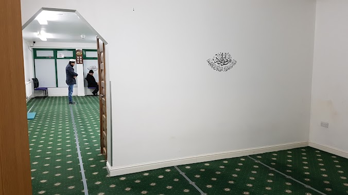
Mosque nearby Wirral Deen Centre
United Kingdom
Mosque nearby Wirral Deen Centre
Wirral Deen Centre
371-375 Borough Road, Birkenhead United Kingdom
contacts phone
:
+44
Latitude:
53.3849399
, Longitude:
-3.0324372
read more
nearest Mosque
332 m
Shah Jalal Mosque Birkenhead
67 Whetstone Lane, Birkenhead
Mosque
read more
4.776 km
Shajalal Muslim Centre
97-103 High Park Street, Liverpool
Mosque
read more
4.874 km
Liverpool Central Mosque
29-31 Hatherley Street, Liverpool
Mosque
read more
4.874 km
Al Rahma Masjid
29-31 Hatherley Street, Liverpool
Mosque
read more
5.777 km
Abdullah Quilliam Mosqe
8-10 Brougham Terrace, Liverpool
Mosque
read more
5.798 km
Al Taiseer Mosque مسجد
65 Aspen Grove, Liverpool
Mosque
read more
6.747 km
Bait-ul-Lateef Mosque. Ahmadiyya Muslim Association Liverpool
309 Breck Road, Liverpool
Mosque
read more
6.755 km
Hamza centre (community center)
106 Lawrence Road, Liverpool
Mosque
read more
7.552 km
Liverpool Mosque and Islamic Institute
8 Cramond Avenue, Liverpool
Mosque
read more
21.882 km
Chester Mosque
23-25 Clifton Drive, Blacon, Chester
Mosque
read more
21.882 km
Chester Mosque & Islamic Centre
23-25 Clifton Drive, Blacon, Chester
Mosque
read more
46.336 km
Masjid E Saliheen Preston Muslim Cultural Centre
21 Fishergate Hill, Preston
Mosque
read more
46.757 km
AL-HUDA
3TH, 14 Avenham Road, Preston
Mosque
read more
46.806 km
Eccles Mosque
5 Liverpool Road, Eccles, Salford
Mosque
read more
47.134 km
Faizan e Madina Preston
14-16 Bence Road, Preston
Mosque
read more
47.481 km
City Mosque Preston
North Road, Preston
Mosque
read more
47.898 km
Madina Mosque
27 William Henry Street, Preston
Mosque
read more
47.983 km
Masjid-e-Falah
135-139, Preston
Mosque
read more
48.029 km
Masjed Alfalah
1PP, 155 Kent Street, Preston
Mosque
read more
48.154 km
Masjid-E-Aqsa
101 Fishwick Parade, Preston
Mosque
read more
48.232 km
Mahadus Shuhada Mosque
3 Holmrook Road, Preston
Mosque
read more
48.26 km
Quwwat Ul Islam Mosque
Peel Hall Street, Preston
Mosque
read more
48.839 km
Masjid e Salaam Preston
49 Watling Street Road, Fulwood, Preston
Mosque
read more
54.712 km
Qadria Jillania
128 York Street, Bury
Mosque
read more
54.728 km
Bury Islamic Centre
Church Street, Bury
Mosque
read more
📑
all categories
Accounting
Administrative area level 1
Administrative area level 2
Airport
Amusement park
Aquarium
Art gallery
Atm
Bakery
Bank
Bar
Beauty salon
Bicycle store
Book store
Bowling alley
Bus station
Cafe
Campground
Car dealer
Car rental
Car repair
Car wash
Casino
Cemetery
Church
City hall
Clothing store
Colloquial area
Convenience store
Courthouse
Dentist
Department store
Doctor
Electrician
Electronics store
Embassy
Establishment
Finance
Fire station
Florist
Food
Funeral home
Furniture store
Gas station
General contractor
Grocery or supermarket
Gym
Hair care
Hardware store
Health
Hindu Temple
Home goods store
Hospital
Insurance agency
Jewelry store
Laundry
Lawyer
Library
Light rail station
Liquor store
Local government office
Locality
Locksmith
Lodging
Meal delivery
Meal takeaway
Mosque
Movie rental
Movie theater
Moving company
Museum
Natural feature
Neighborhood
Night club
Painter
Park
Parking
Pet store
Pharmacy
Physiotherapist
Place of worship
Plumber
Point of interest
Police
Political
Post office
Premise
Real estate agency
Restaurant
Roofing contractor
Route
Rv park, camping
School
Shoe store
Shopping mall
Spa
Stadium
Storage
Store
Subpremise
Subway station
Supermarket
Synagogue
Taxi stand
Train station
Transit station
Travel agency
University
Veterinary care
Zoo
administrative area level 3
administrative area level 4
sublocality level 1
↑