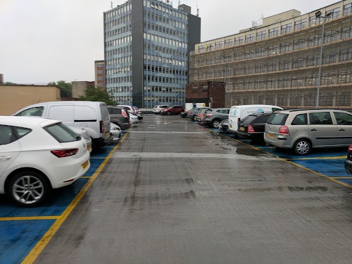
Parking nearby Mitchell Lane Travelodge
United Kingdom
Parking nearby Mitchell Lane Travelodge
Mitchell Lane Travelodge
100 Canynge Street, Bristol United Kingdom
contacts phone
:
+44
Latitude:
51.4506333
, Longitude:
-2.5881906
read more
nearest Parking
18 m
Bristol Mitchell Lane Travelodge Car Park - Bristol | APCOA
Bristol Mitchell Lane Travelodge, Mitchell Lane, Bristol
Parking
read more
176 m
Parking Kościół św. Maria Redcliffe
Portwall Lane, Bristol
Parking
read more
176 m
Bristol First Hotel
Church Street, Bristol
Parking
read more
183 m
Portwall Lane
Phippen Street, Bristol
Parking
read more
305 m
Redcliffe Wharf Car Park
6NE, Redcliffe Way, Bristol
Parking
read more
380 m
Redcliffe Parade
8 Redcliffe Parade East, Bristol
Parking
read more
507 m
1 Queen St Garage
1 Queen Street, Bristol
Parking
read more
527 m
The Grove Car Park
40 The Grove, Bristol
Parking
read more
604 m
Radisson Blu Car Park
Marsh Street, Bristol
Parking
read more
608 m
NCP Prince Street MSCP
Prince Street, Bristol
Parking
read more
684 m
NCP Car Park
Fairfax Street, Bristol
Parking
read more
702 m
Nelson Street Car Park
All Saints' Street, Bristol
Parking
read more
710 m
Wapping Wharf Car Park
Wapping Road, Bristol
Parking
read more
722 m
Parking Quorum
Bristol
Parking
read more
789 m
St John'S Rd Parking
St John'S Rd, Bristol
Parking
read more
851 m
65 Avon St Parking
65 Avon St, Bristol
Parking
read more
854 m
15 Willway St Parking
15 Willway St, Bristol
Parking
read more
854 m
15 Willway St Parking
15 Willway Street, Bristol
Parking
read more
970 m
Old Park Hill Gravel
12 Old Park Hill, Bristol
Parking
read more
990 m
Parking
Canon's Marsh, Bristol
Parking
read more
997 m
Frog Lane
Frog Lane, Bristol
Parking
read more
997 m
Frog Lane
Frog Ln, Bristol
Parking
read more
1.034 km
Cabot Circus Parking
Dale Street, Bristol
Parking
read more
1.099 km
Bedminster Car Park
Dalby Avenue, Bristol
Parking
read more
1.177 km
Oxford Street Car Park
Oxford Street, Bristol
Parking
read more
📑
all categories
Accounting
Administrative area level 1
Administrative area level 2
Airport
Amusement park
Aquarium
Art gallery
Atm
Bakery
Bank
Bar
Beauty salon
Bicycle store
Book store
Bowling alley
Bus station
Cafe
Campground
Car dealer
Car rental
Car repair
Car wash
Casino
Cemetery
Church
City hall
Clothing store
Colloquial area
Convenience store
Courthouse
Dentist
Department store
Doctor
Electrician
Electronics store
Embassy
Establishment
Finance
Fire station
Florist
Food
Funeral home
Furniture store
Gas station
General contractor
Grocery or supermarket
Gym
Hair care
Hardware store
Health
Hindu Temple
Home goods store
Hospital
Insurance agency
Jewelry store
Laundry
Lawyer
Library
Light rail station
Liquor store
Local government office
Locality
Locksmith
Lodging
Meal delivery
Meal takeaway
Mosque
Movie rental
Movie theater
Moving company
Museum
Natural feature
Neighborhood
Night club
Painter
Park
Parking
Pet store
Pharmacy
Physiotherapist
Place of worship
Plumber
Point of interest
Police
Political
Post office
Premise
Real estate agency
Restaurant
Roofing contractor
Route
Rv park, camping
School
Shoe store
Shopping mall
Spa
Stadium
Storage
Store
Subpremise
Subway station
Supermarket
Synagogue
Taxi stand
Train station
Transit station
Travel agency
University
Veterinary care
Zoo
administrative area level 3
administrative area level 4
sublocality level 1
↑