places in Plymouth
Coronavirus disease (COVID-19) Situation
confirmed cases
24910387
deaths
232112
United Kingdom
Plymouth
Plymouth
Administrative Region:
England
population:
266 983
calling code:
+44-1752
postcode:
PL1-PL9
PL95
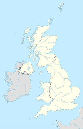
Location on the map of United Kingdom
Plymouth
Church
Flavel Church
Mayor's Avenue, Dartmouth
Church
read more
Connon Methodist Church
Saint Pinnock, Liskeard
Church
read more
Forrabury Church
Forrabury Stitches, Boscastle
Church
read more
Methodist Free Church
19 Market Place, Camelford
Church
read more
St Paul’s Church
100 Efford Lane, Efford, Plymouth
Church
read more
Church of St Mary & St Julian
Maker, Torpoint
Church
read more
Saint Andrew's Church
14 Saint Andrew's Place, Cawsand, Torpoint
Church
read more
St Andrew C Of E Church
Diddies Road, Bude
Church
read more
St John C Of E Church
The Old Rectory, Rame, Torpoint
Church
read more
Rame Church
Ramehead Lane, Rame, Torpoint
Church
read more
Sclerder Abbey
Sclerder Lane, Looe
Church
read more
The Old Chapel
4 Summer Lane, Pelynt, Looe
Church
read more
Landulph Church
Landulph, Saltash
Church
read more
Parish Church of Saint Nun Pelynt
Looe
Church
read more
Bolventor Church
Launceston
Church
read more
Chemin Neuf Community at the Sclerder Abbey
Sclerder La, Looe
Church
read more
The Old Chapel Duloe
Duloe, Liskeard
Church
read more
Wesleyan Chapel
Launceston
Church
read more
Trevelmond Methodist Church
Liskeard
Church
read more
Tredinnick Methodist Church
Liskeard
Church
read more
Saint Neot Methodist Church
1 Carlyon, Saint Neot, Liskeard
Church
read more
Saint Marnarch's Parish Church Lanreath
2 Court Meadow, Lanreath, Looe
Church
read more
Saint Ildierna
Looe
Church
read more
All Saints Church
Church Hill, Herodsfoot, Liskeard
Church
read more
Boconnoc
Boconnoc, Lostwithiel
Church
read more
City hall
Launceston Town Hall
Westgate Street, Launceston
City hall
read more
Plympton St Maurice Guildhall
42 Fore Street, Plymouth
City hall
read more
Plymouth City Council
Civic Centre, 71 New George Street, Plymouth
City hall
read more
Plymouth City Council
71 New George Street, Plymouth
City hall
read more
Ivybridge Town Council
Town Hall, Erme Court, Leonards Road, Ivybridge
City hall
read more
Clothing store
The Edinburgh Woollen Mill
20 The Barbican, Plymouth
Clothing store
read more
Run with Scissors
8 Elliot Street, Plymouth
Clothing store
read more
New Look
Unit 17, Drake Circus Shopping Centre, Plymouth
Clothing store
read more
Blue Banana
18 Cornwall Street, Plymouth
Clothing store
read more
Karen Millen
Dingles Of Plymouth, House Of Fraser, 40-46 Royal Parade, Plymouth
Clothing store
read more
Boux Avenue
34, Drake Circus Shopping Centre, Plymouth
Clothing store
read more
Mountain Warehouse
Unit 9, Drakes Circus, Charles Street, Plymouth
Clothing store
read more
White Stuff Ltd
40-46 Royal Parade, Plymouth
Clothing store
read more
Fa Plymouth
18 Old Town Street, Plymouth
Clothing store
read more
JD Sports
52 New George Street, Plymouth
Clothing store
read more
Phase Eight Concession
Dingles Of Plymouth, 40/46 Royal Parade, Plymouth
Clothing store
read more
Early Learning Centre
11 Cornwall Street, Plymouth
Clothing store
read more
Joules
Drake Circus Shopping Mall, 1 Charles Street, Plymouth
Clothing store
read more
Topshop
18 New George Street, Plymouth
Clothing store
read more
25 Menswear
35-37 Mayflower Street, Plymouth
Clothing store
read more
HoF Plymonth
Unnamed Road, Plymouth
Clothing store
read more
BadRhino
40 New George Street, Plymouth
Clothing store
read more
Kulfi
7 Market Place, Camelford
Clothing store
read more
Estee Lauder
Debenhams Plymouth, Royal Parade, Plymouth
Clothing store
read more
Gummee Ltd
Trehare, Calstock
Clothing store
read more
Primark
Drake Circus Shopping Centre, Unit 1, 1 Charles St, Plymouth
Clothing store
read more
The Perfume Shop
23, 1 Charles Street, Plymouth
Clothing store
read more
St Luke's
29 Southside Street, Plymouth
Clothing store
read more
Wallis
2 Woolwell Crescent, Roborough, Plymouth, England, Roborough
Clothing store
read more
The Officers Club
79 New George Street, Plymouth
Clothing store
read more
Colloquial area
Cornwall
Zjednoczone Królestwo
Colloquial area
read more
Convenience store
Horrabridge Stores
Commercial Road, Horrabridge, Yelverton
Convenience store
read more
Duloe Community Shop
Jubilee Close, Liskeard
Convenience store
read more
SPAR Camelford
13 - 15 Market Place, Camelford
Convenience store
read more
Costcutter
Bude Holiday Park, Maer Lane, Bude
Convenience store
read more
McColl's
Warrenstone, Costly Sreet, Ivybridge
Convenience store
read more
Beach House Shop & Wet Fish Ltd
Beach House Cottage, Marine Drive, Widemouth Bay, Widemouth Bay, Bude
Convenience store
read more
SPAR
Penally Hill, Boscastle
Convenience store
read more
Co-op Food
14 Glanvilles Mill Rd, Ivybridge
Convenience store
read more
Altarnun Village Shop
Rose Hill, Altarnun, Launceston
Convenience store
read more
Holywell Stores
Saint Ann's Chapel, Kingsbridge
Convenience store
read more
SPAR Bodmin Moor
Altarnun, Launceston
Convenience store
read more
SPAR
Bencoolen Road, Bude
Convenience store
read more
Admiralty Street Store
Plymouth
Convenience store
read more
Sainsbury's Local
61 Ebrington Street, Plymouth
Convenience store
read more
Stentaway Stores
6 Stentaway Drive, Plymouth
Convenience store
read more
Co-op Food - St Georges Terrace
25-26 Saint George's Terrace, Plymouth
Convenience store
read more
Co-op Food - Ernesettle
34 Hornchurch Road, Plymouth
Convenience store
read more
College Road Stores
55 College Road, Plymouth
Convenience store
read more
Co-op Food - Stoke Village
36-40 Devonport Road, Plymouth
Convenience store
read more
Colebrook Stores
Colebrook Road, Plymouth
Convenience store
read more
Costcutter
56 Station Road, Plymouth
Convenience store
read more
Co-op Food - Albert Road - Devonport
154-158 Albert Road, Plymouth
Convenience store
read more
Best-One
322-324 Union Street, Plymouth
Convenience store
read more
The Punchbowl Premier Express
3 Wolseley Road, Plymouth
Convenience store
read more
Co-op Food
Wolseley Close, Ford, Plymouth
Convenience store
read more
📑
Plymouth all categories
Accounting
Airport
Amusement park
Aquarium
Art gallery
Atm
Bakery
Bank
Bar
Beauty salon
Bicycle store
Book store
Bowling alley
Bus station
Cafe
Campground
Car dealer
Car rental
Car repair
Car wash
Casino
Cemetery
Church
City hall
Clothing store
Colloquial area
Convenience store
Courthouse
Dentist
Department store
Doctor
Electrician
Electronics store
Finance
Fire station
Florist
Food
Funeral home
Furniture store
Gas station
General contractor
Grocery or supermarket
Gym
Hair care
Hardware store
Health
Home goods store
Hospital
Insurance agency
Jewelry store
Laundry
Lawyer
Library
Liquor store
Local government office
Locality
Locksmith
Lodging
Meal delivery
Meal takeaway
Mosque
Movie rental
Movie theater
Moving company
Museum
Natural feature
Neighborhood
Night club
Painter
Park
Parking
Pet store
Pharmacy
Physiotherapist
Place of worship
Plumber
Point of interest
Police
Post office
Premise
Real estate agency
Restaurant
Roofing contractor
Route
Rv park, camping
School
Shoe store
Shopping mall
Spa
Stadium
Storage
Store
Subpremise
Supermarket
Synagogue
Taxi stand
Train station
Transit station
Travel agency
University
Veterinary care
Zoo
administrative area level 3
administrative area level 4
sublocality level 1
↑