Skole i nærheden Mansbridge Community Pre-school
Det Forenede Kongerige
Skole i nærheden Mansbridge Community Pre-school
Mansbridge Community Pre-school
Octavia Road, Mansbridge, Southampton Det Forenede Kongerige
kontakter telefon
:
+44
Latitude:
50.9396641
, Longitude:
-1.3690201
læs mere
nærmeste Skole
23 m
Mansbridge Primary School
16 Octavia Road, Southampton
Skole
læs mere
714 m
Guitar Lessons Southampton
Market Buildings, High Road, Southampton
Skole
læs mere
837 m
Universities And High Schools
19-31 High Road, Southampton
Skole
læs mere
1.037 km
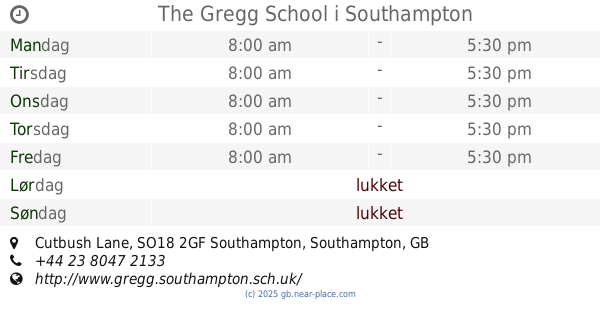
The Gregg School
Townhill Park House, Cutbush Lane, Southampton
Skole
læs mere
1.177 km
NG Project Schools & Co LTD.
Cutbush Lane, Chartwell Green, Southampton
Skole
læs mere
1.182 km
St George Catholic College
Leaside Way, Southampton
Skole
læs mere
1.189 km
All Hallows Too
Townhill Community Centre/Meggeson Avenue, Southampton
Skole
læs mere
1.293 km
Townhill Junior School
Benhams Road, Southampton
Skole
læs mere
1.342 km
Riverside Pre-School
Riverside Pre-school, c/o Bitterne Park Primary School, Manor Farm Road, Southampton
Skole
læs mere
1.364 km
Paint Pots Pre-School
244 Burgess Road, Southampton
Skole
læs mere
1.377 km
Townhill Infant School
Benhams Road, Southampton
Skole
læs mere
1.426 km
Richard Jovie
17 Woodmill Lane, Southampton
Skole
læs mere
1.535 km
Honeybeez Pre School
Honeysuckle Road, Southampton
Skole
læs mere
1.559 km
Hardmoor Early Years Centre
Leaside Way, Southampton
Skole
læs mere
1.574 km
Olsen R a S
3/Stoneham Court/Bassett Green Rd, Southampton
Skole
læs mere
1.583 km
Swaythling Primary School
Mayfield Road, Southampton
Skole
læs mere
1.585 km
Portswood Primary Academy Trust
Portswood Primary School, Somerset Road, Southampton
Skole
læs mere
1.771 km
London school of Sports Massage
263 Burgess Road, Southampton
Skole
læs mere
1.771 km
Squirrels Corner Pre-school
Townhill Way, Southampton
Skole
læs mere
1.782 km
The Mulberry Bush
Witts Hill, Southampton
Skole
læs mere
1.825 km
Chemistry Building (27)
22 Hartley Avenue, Southampton
Skole
læs mere
1.869 km
Froude Building (28)
22 Hartley Avenue, Southampton
Skole
læs mere
1.952 km
Saint Denys Primary School
Dundee Road, Southampton
Skole
læs mere
1.976 km
Moorlands Primary School Southampton
Kesteven Way, Southampton
Skole
læs mere
2.386 km
primary school
9 Vine Bank, Southampton
Skole
læs mere
📑
alle kategorier
Administrative område niveau 1
Administrative område niveau 2
Advokat
Akvarium
Ambassade
Apotek
Bageri
Bank
Bar
Begravelse hjem
Bibliotek
Bilforhandler
Bilreparationer
Bilvask
Biograf
Blikkenslager
Blomsterhandler
Bog butik
Bowlingbaner
Brandstation
Busstoppested
Butik
Bydel niveau 1
Cafe
Campingplads
Cykel butik
Dagligdags område
Dagligvarebutik
Dyrehandel
Dyrlægebehandling
Ejendomsmægler
Elektriker
Elektronik butik
Etablering
Filmudlejning
Finansiere
Flyttefirma
Forlystelsespark
Forsikring agentur
Forudsætning
Fysioterapeut
Guldsmed
Gym
Hindu Temple
Hjem varer butik
Hospital
Hovedentreprenør
Hårpleje
Indkøbscenter
Isenkræmmer
Kasino
Kirke
Kirkegård
Kommunen
Kunstgalleri
Købmand eller supermarked
Letbane station
Logi
Lokalitet
Lufthavn
Låsesmed
Læge
Mad
Maler
Metrostation
Moske
Museum
Måltid levering
Måltid takeaway
Møbelbutik
Nabolag
Natklub
Naturlige træk
Opbevaring
Parkere
Parkering
Pengeautomat
Politi
Politisk
Postkontor
Punkt af interesse
Regnskab
Rejsebureau
Restaurant
Retsbygning
Rute
Rv park, camping
Rådhus
Sko butik
Skole
Skønhedssalon
Spa
Stadion
Sted for tilbedelse
Stormagasin
Subpremise
Sundhed
Supermarked
Synagoge
Tagdækning entreprenør
Tandlæge
Tankstation
Taxaholdeplads
Togstation
Transit station
Tøjbutik
Universitet
Vasketøj
Vinhandel
Zoo
administrative område niveau 3
administrative område niveau 4
biludlejning
↑