Bar nearby Bowl Inn
United Kingdom
Bar nearby Bowl Inn
Bowl Inn
16 Church Road, Almondsbury, Bristol Reino Unido
contacts phone
:
+44
Latitude:
51.5545971
, Longitude:
-2.5725327
read more
nearest Bar
647 m
North Bristol Rugby Football Club
Oaklands, Gloucester Road, Almondsbury, Bristol
Bar
read more
1.302 km
North Bristol Rugby Club
Aztec West, Almondsbury, Bristol
Bar
read more
1.329 km
Saffron
4-5, Woodlands Business Park, Woodlands, Bradley Stoke, Bristol
Bar
read more
1.335 km
From future inn Hotel bristol to
105 Ottrells Mead, Bradley Stoke, Bristol
Bar
read more
1.654 km
Travellers Rest
Gloucester Road, Patchway, Bristol
Bar
read more
1.755 km
Hollow Tree
Brook Way, Bradley Stoke, Bristol
Bar
read more
1.997 km
Patchway Labour Club
The Parade, Coniston Road, Bristol, Patchway
Bar
read more
2.13 km
Swan Inn
Tockington Green, Tockington
Bar
read more
2.406 km
The Swan Inn
Lower Tockington Road, Tockington, Bristol
Bar
read more
2.652 km
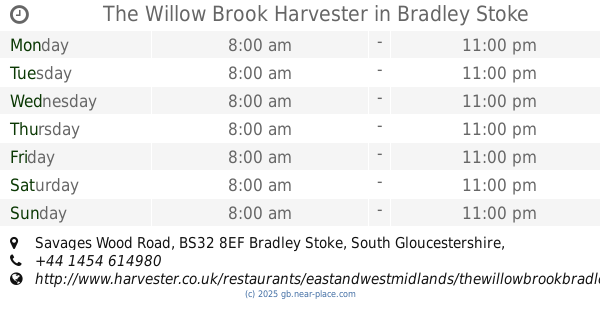
The Willow Brook Harvester
5-7, Savages Wood Road, Bradley Stoke, Bristol
Bar
read more
2.686 km
Harvester
Town Square, Bristol
Bar
read more
2.793 km
The Three Brooks
Bradley Stoke District Centre, Bradley Stoke
Bar
read more
2.876 km
Mahek Indian Dining & Takeaway
79 Gloucester Road, Patchway, Bristol
Bar
read more
3.14 km
The White Hart
The Street, Olveston, Bristol
Bar
read more
3.199 km
Olveston Sports & Social Club
14 Alveston Road, Bristol
Bar
read more
3.639 km
Scavi & Ray Prosecco
116 Merlin Road, Patchway, Bristol
Bar
read more
3.78 km
The Mason's Arms Stonehouse
Masons Arms, 94 Gloucester Road, Rudgeway, Bristol
Bar
read more
3.956 km
Bailey's Court Inn
Baileys Court Road, Stoke Gifford, Bristol
Bar
read more
4.057 km
Las Iguanas - Bristol Cribbs Causeway
The Venue At Cribbs Causeway, Merlin Road, Patchway, Bristol
Bar
read more
4.335 km
Miller & Carter Cribbs Causeway
Cribbs Causeway, Bristol
Bar
read more
4.51 km
Redwood Farm, Dining & Carvery
Catbrain Lane, Patchway, Bristol
Bar
read more
4.919 km
Plough Inn
127 Gloucester Road North, Bristol
Bar
read more
5.056 km
The Mile Straight
12 New Road, Stoke Gifford, Bristol
Bar
read more
5.32 km
Thornbury Golf Centre
Bristol Road, Thornbury, Bristol
Bar
read more
5.686 km
George and Dragon
Winterbourne Hill, Winterbourne, Bristol
Bar
read more
📑
all categories
Accounting
Administrative area level 1
Administrative area level 2
Airport
Amusement park
Aquarium
Art gallery
Atm
Bakery
Bank
Bar
Beauty salon
Bicycle store
Book store
Bowling alley
Bus station
Cafe
Campground
Car dealer
Car rental
Car repair
Car wash
Casino
Cemetery
Church
City hall
Clothing store
Colloquial area
Convenience store
Courthouse
Dentist
Department store
Doctor
Electrician
Electronics store
Embassy
Establishment
Finance
Fire station
Florist
Food
Funeral home
Furniture store
Gas station
General contractor
Grocery or supermarket
Gym
Hair care
Hardware store
Health
Hindu Temple
Home goods store
Hospital
Insurance agency
Jewelry store
Laundry
Lawyer
Library
Light rail station
Liquor store
Local government office
Locality
Locksmith
Lodging
Meal delivery
Meal takeaway
Mosque
Movie rental
Movie theater
Moving company
Museum
Natural feature
Neighborhood
Night club
Painter
Park
Parking
Pet store
Pharmacy
Physiotherapist
Place of worship
Plumber
Point of interest
Police
Political
Post office
Premise
Real estate agency
Restaurant
Roofing contractor
Route
Rv park, camping
School
Shoe store
Shopping mall
Spa
Stadium
Storage
Store
Subpremise
Subway station
Supermarket
Synagogue
Taxi stand
Train station
Transit station
Travel agency
University
Veterinary care
Zoo
administrative area level 3
administrative area level 4
sublocality level 1
↑